Wednesday, May 24, 2023
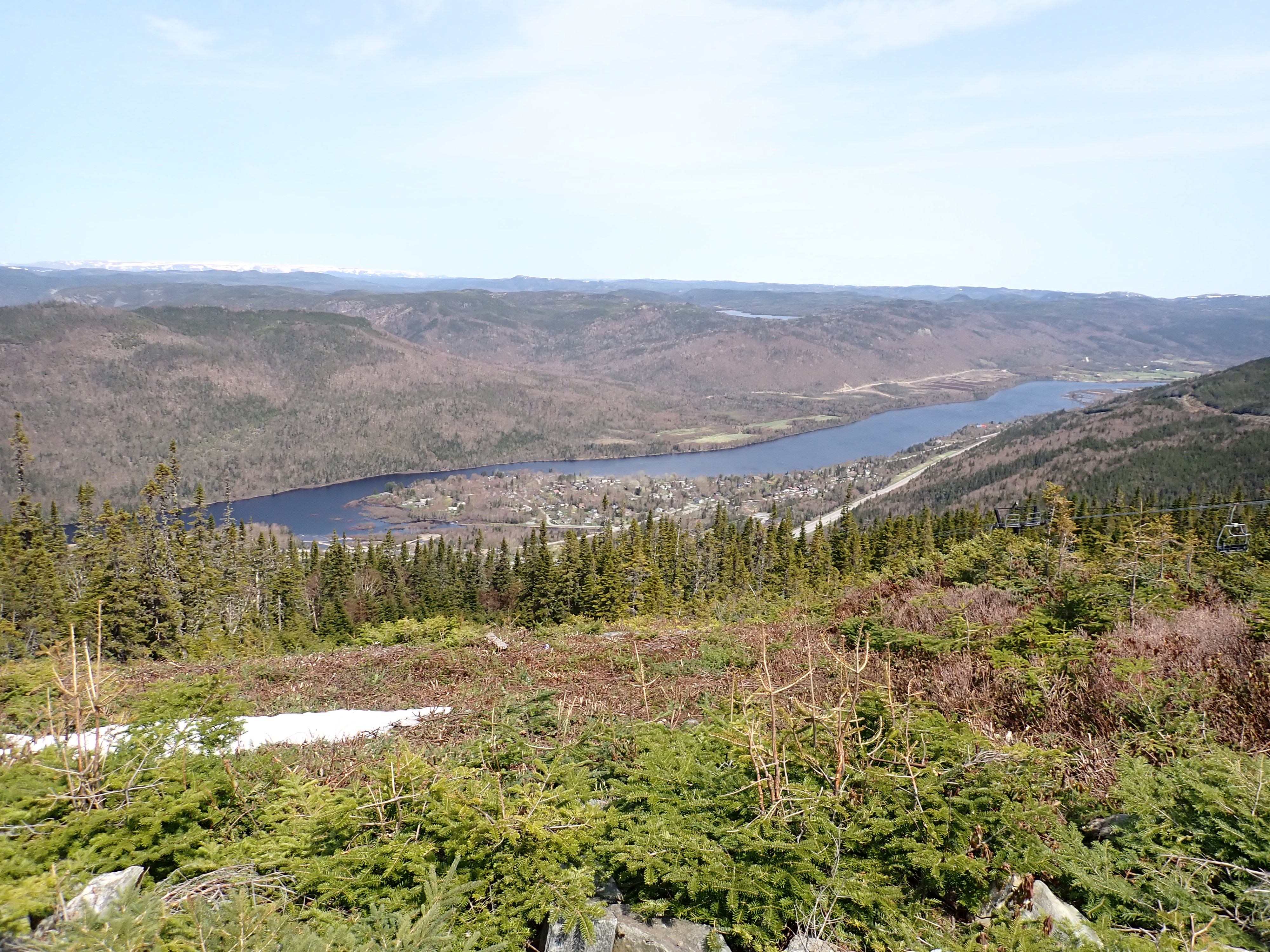
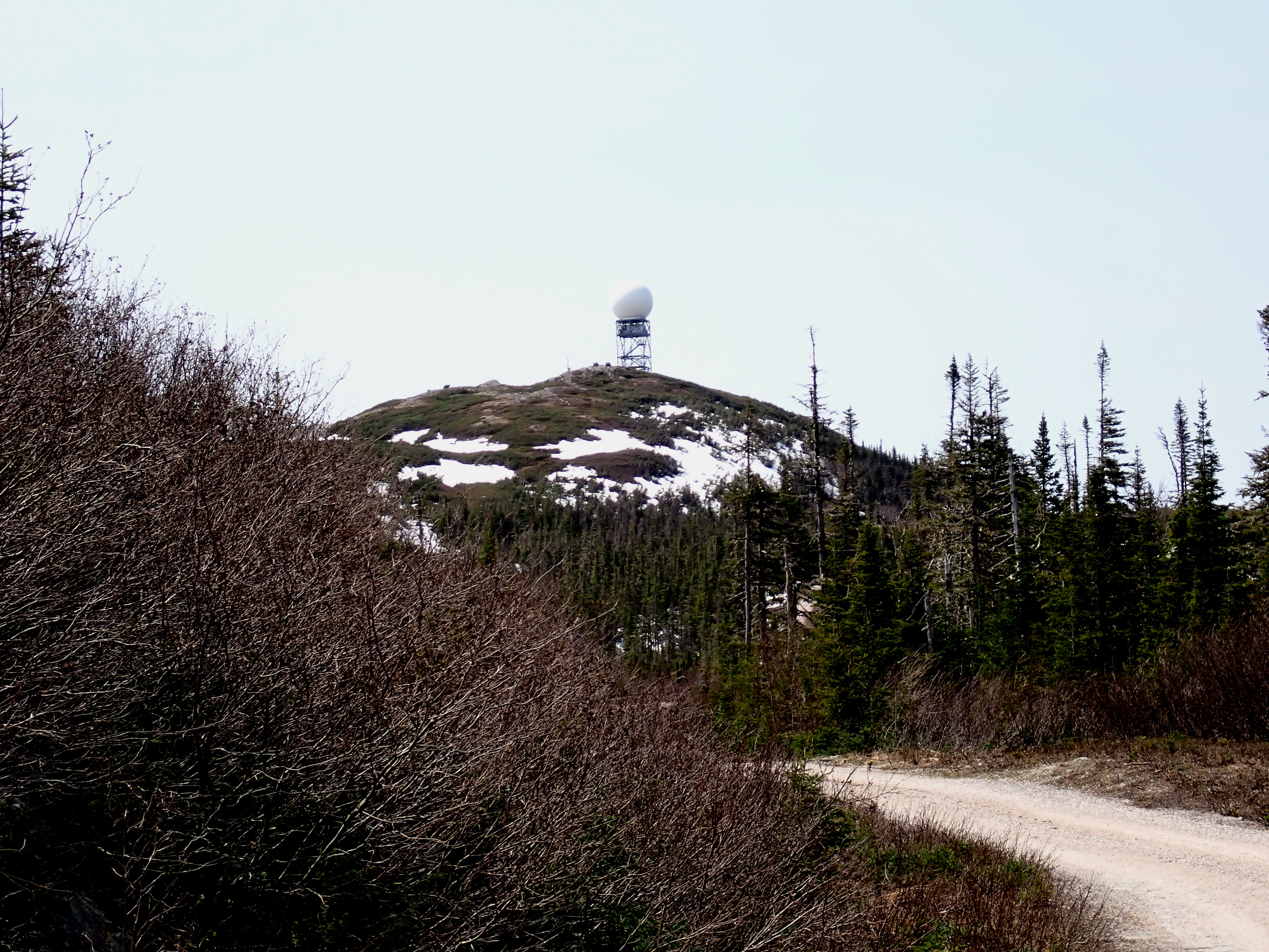
Marble Mountain is a major monument that looms over the Humber River and Corner Brook in Newfoundland. It is the base for a Doppler Radar installation, and it is a well-loved local ski resort. We learned that two of the area's most interesting hikes are to climb to Steady Brook Falls, which tumbles down a ravine on one side of Marble Mountain, and then climb the mountain itself to the top of the ski runs. We decided to give it a try. We found the trailhead:

Our trail clambered up some long staircases and the side of a slope, past a few zipline platforms, and then we burst out on this view of Steady Brook Falls:

Look at this video to see how much water was rushing over the falls.
From the viewpoint for the falls, we moved steadily up the mountain until we reached "Country Road," a gravel road that climbs the mountain and doubles in the winter as one of the ski runs. We heard that it is possible to find a trail out to the top of the falls, so we sought that out. Finally, we found a break in the trees leading off Country Road in the direction of the roar of the water, and decided to try it, even though it looked as if it had not been maintained in some years.
Below, Kathy straddles a tree that was impertinent enough to fall over the trail. Where is the trail maintenance crew when we need it?


At this elevation, the temperature had gotten significantly colder and the winds were brisk, so we had to layer up and look for a sheltered spot to eat our lunch. Dave found a large rock in the lee of a rock ledge, where he had the company of a snowdrift as he munched his peanut butter and jelly sandwich (on sourdough, he points out):

We rested a bit, rehydrated, digested our lunch a mite, and then stretched our stiff legs to start the 2 mile hike straight downhill. The total mileage for the hike was 5 miles (2 miles up and 2 miles down, with side trips), and our elevation gain over 1200 feet, which made for steep walking, although the road was less strenuous than a trail would have been.
Nevertheless, by the time we reached our Jeep, we had built up a powerful thirst, and repaired to Broomstick Brewing in downtown Corner Brook to sample some of their locally brewed beers. Kathy added a little protein from salmon skewers and curried chick peas to her meal; David merely sampled small bites of Kathy's dish.
With that, we headed back to Ruby the Adventure Cat, some chores around the RV, and a scrumptious dinner of Poached Halibut and Stir-Fried Garlic Scapes à la Kathleen, which filled our bellies and put us in the mood for a restful sleep.
Tomorrow is mainly logistics, and the next day we move on to our next campground, so we may not have another blog entry for you for a few days.
No comments:
Post a Comment
Note: Only a member of this blog may post a comment.