Search This Blog

Tuesday, June 28, 2022

Hiking South Valley Trail in Prince William Forest Park

After hiking the North Valley Trail along Quantico Creek last Wednesday, we haven't gotten out as much as we'd like because we're helping our son, daughter-in-law and grandson prepare to leave for a new job overseas.  We were off duty today, so we decided to try another trail in Prince William Forest Park.  This trail followed the South Fork of Quantico Creek, and led us from one of the parking areas, three miles along the creek, to a man-made lake near two cabin camps (more on that later).

Our trail started out near a shorter trail known as the "Algonquian Trail" because local tribes of the Algonquian Nation had lived and hunted in this region and followed trails along this creek:

 
Much of the trail runs along the South Fork of Quantico Creek, and it showcases the geology of the area, including these blocky cliffs of ancient volcanic stone:

 
The terrain is rolling, having been eroded over millennia by floodwaters and runoff.  At one point, we could see the uneroded shoulder of one old formation, which to us looked like the back of a sleeping dinosaur:

 
While the trail followed the north bank of the creek, we crossed numerous bridges spanning tributaries.  Here, David admires one of the newer bridges:

 
At this time of early summer, the streamside vegetation was lush, and a number of sections of water were open and free of deadfall:

 
In one open section of the stream, Kathy spotted this larger fish, which might have been a young bass, well disguised as he held among rafts of vegetation to snare morsels of food as they floated downstream:

 
We were astounded as how huge the rootball of this fallen old tree was.  The woods harbored a number of very old hardwood trees along with much younger ones.

 
Most of the Spring blossoms are past their prime, but we did spot this beautiful wildflower, and Kathy picked some early-ripened raspberries, most of which are not yet due for another week or two.  We resolved to come back in a short while to see if we can pluck some perfectly red, ripe ones!

 
Many sections of the trail boast the original stonework of the Civilian Conservation Corps, or CCC, which constructed the trail, but in places, more recent improvements, such as this wooden railing, have been added:

Speaking of big old trees, David found another one, and gave it a hug to let it know we appreciate the fact that it's still standing:

 
The Park abuts Quantico Marine Base.  During part of our hike, we heard a series of helicopter-type noises overhead, and finally got a glimpse of one of the craft, which was an Osprey, presumably practicing maneuvers:

 
The noisy activity above didn't seem to disturb the bucolic calm below, however, and we found placid beauty everywhere we looked along the stream:

 
Nearing the lake, which was to be our lunch spot and turnaround point, we passed this arching footbridge, which is of quite a unique design.   We learned later that it was built by the Sierra Club as a demonstration project.

 
Here is another view of the bridge from below along the Creek.  See if you can spot Kathy peeking out from atop it:

 
Just after the bridge, we reached the spillway of the dam that impounds Lake 2 and 5.  It was hard to get close enough and in an appropriate location to get a good photo, but the one below should give you an idea how high and impressive it was for such a small stream:

 
Prior to its establishment as Prince William Forest Park, the park's land was known as the Chopawamsic Recreational Demonstration Area.  Recreation Demonstration Areas (or "RDA"s) were conceived in the 1930's to make outdoor resources available to inner-city residents.  The CCC started work on the Chopawamsic RDA in 1935, building five cabin camps in the park for use by urban youth groups and welfare agencies. During World War II, the park and cabin camps used by the Office of Strategic Services as a training grounds for recruits. Today, the cabins can be rented out by different groups and individuals.
 
Passing the dam and spillway, we reached Lake 2 and 5 itself, so called because it was constructed by the CCC for recreation by users of Cabin Camps 2 and 5.  The photo below shows an old dock presumably used for boating and to contain a swimming area for campers.  It was on the opposite side of the lake, which was a further hike than we were planning, so we didn't have a chance to walk out on the dock and check out the Cabin Camp.

 
We explored the far end of the lake and returned to a pretty little postage-stamp beach to rest, admire the view, and eat our lunch --

-- before returning the 3 miles back to our trailhead.  The day was relatively cool, in the mid-70's, and with low humidity, so, with a light breeze and the shade of the forest, we had a most enjoyable sojourn.

Stay healthy and happy my friends!
 

Wednesday, June 22, 2022

Hiking Quantico Creek in Prince William Forest Park

Wednesday, June 22, 2022

Hi Blog!

We finished our two weeks at Bull Run and have moved over to the Prince William Forest RV Campground in Dumfries, Virginia. We had stayed here before, but never had enough time to explore. We hope between taking care of our Grandpuppy Bubu after his hip surgery and ferrying William to and from golf camp, that we'll find time to explore the 37 miles of hiking trails and 21 miles of biking trails. 

 We made our first stop of the day at the Visitor Center to pick up maps and information.


Prince William Forest Park is an interesting place. The story starts with President Franklin D. Roosevelt's New Deal. In 1933, Roosevelt created a new kind of park, the Recreational Demonstration Area (RDA) to reuse marginal, overworked land. The park was built by the New Deal's Civilian Conservation Corp (CCC). Over 2,000 CCC enrollees came to work along the Chopawamsic and Quantico Creeks. The Chopawamsic RDA (now known as Prince William) was a model for the entire nation, one of 46 such land-use park projects. It was to be a new type of camp where low-income, inner-city children and families could get away and experience the great outdoors.

The CCC camping cabins were ready in the summer of 1936. There were camps for boys, girls and mothers and tots. Each camp housed up to 200, who stayed for two to three weeks. Charity-funded groups and social agencies sponsored and ran the camps. While the Chopawamsic RDS was the first to welcome inner-city kids, the camps were segregated by race. Today, the larger cabins are still used by various organizations, but a few of the smaller cabins are available for rent. 
 
You, too, can stay in an original CCC cabin! (Pretty sure the window air conditioner was not part of the original design.)


For today's adventure, we set our sights on the old Cabin Branch Mine site. We decided we would approach the old mine site by hiking down the Quantico Cascades Trail to Quantico Falls, and then down the North Valley Trail. 
 
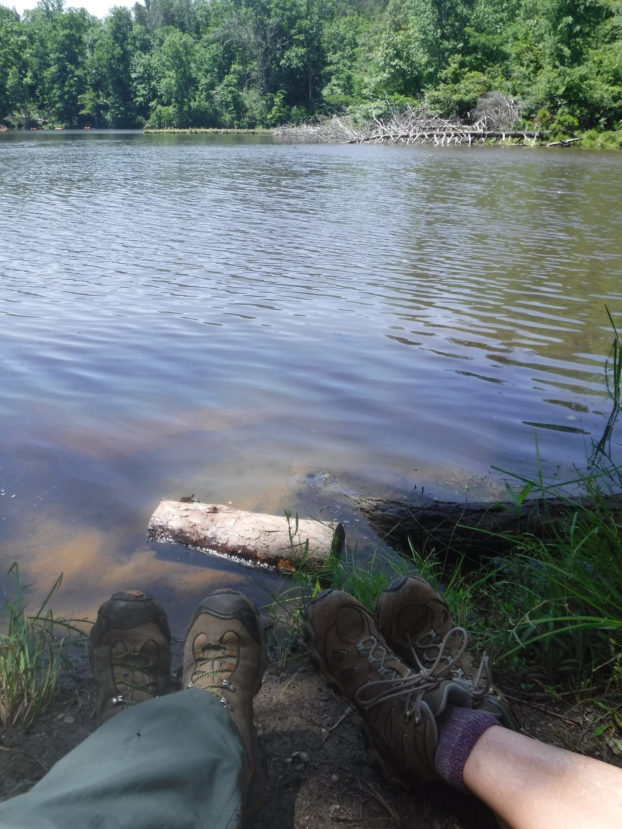
To reach our trailhead, we took the park's Scenic Drive, a ten mile loop around the heart of the park. We made a quick detour to check out Carter's Pond. We later learned that there is a black bear that likes to hang out there. Unfortunately, we didn't spot the bear during our stop.


The first part of our hike was along the Quantico Cascade Trail which leads downhill to Quantico Creek.  It is coincident with the Park's Geology Trail, which informs the hiker about the geology of this area.
 
"What geology?" you ask. 
 
Prince William Forest Park is located along the Fall Line between the Piedmont Region and Coastal Plains in Virginia. Piedmont is an Italian word that means "foot of the mountain." The Piedmont Region of Virginia is located to the east of the Blue Ridge Mountains and west of the Fall Line. The Fall Line is the natural border that lies between the Piedmont Region and the Coastal Plain/Tidewater Region.

It just wouldn't be a good hike if we didn't start with a trailhead selfie!


Since our hike followed the Geology Trail, there were still several of old "hysterical" markers still remaining that discuss the geology of this region, but many of the old markers were damaged by weather and falling trees. Today, folks can follow this link to the Geology E-Trail.
 
David was intrigued with the idea of a Geology Trail, and wondered what we would find:


Well, here is what we found.
 
The rocks laying in Quantico Creek are the metamorphosed remnants of ocean sediments and volcanic flows. These rocks are part of the Chopawamsic (Chop-uh-wam-zik) formation. Chopawamsic rocks cover almost of the entire northern and western sections of the park. The pinkish lines running through the rock are quartz and formed as an addition to the rock at a much later date.


At the Cascades, we discovered the first wildlife of the day (well, if you don't count the dozens of squirrels, which were everywhere)! Ruby would have loved to visit this park.


It's not often you find trees on the East Coast that are so large you can't wrap your hands around them.


Hidden beneath the layers of soil and leaves at this site is the boundary between the Piedmont and Coastal Plain. The cascading sections of the north branch of Quantico Creek reveal the presence of this boundary. 
 
The Fall Line is the name given to this boundary between the Piedmont and Coastal regions.  It extends from New Jersey to Georgia. The stream flows downstream through natural cracks or joint systems in the rock. During floods, the seemingly immovable rocks in this stream are rolled along the bed or bottom. This part of Quantico Creek is transporting large amounts of sediment as well as eroding the exposed rocks.


Prince William Forest Park preserves approximately 15,000 acres of Piedmont forest covering a significant portion of the Quantico Creek watershed. The park represents one of the largest parcels of undeveloped land in the area and is the third largest unit of the National Park System in Virginia. That, combined with the fact that it is the largest example of a Piedmont forest in the national park system, makes it a significant natural resource. 
 
Besides that, it is really cool on a hot summer day!


It is amazing, after all these years, to find the work of the CCC sprinkled around the park. For example, we happened upon this simple bench built in 1933 that will probably still be here in 2033:


After meandering along the North Valley Trail, we found the first evidence of the Cabin Branch Pyrite Mine. The concrete foundations are still visible.


The Cabin Branch Pyrite Mine began operations in 1889 after pyrite (a shiny yellow mineral consisting of iron disulfide and also known as "fools gold") was discovered near the North and South Forks of the Quantico Creek. The Cabin Branch Mining Company operated from 1889 to 1908 on a limited basis and provided opportunities for industrial growth in the area following the Civil War. Pyrite was used to create sulfur, which was a necessary ingredient in products such as glass, soap, bleach, textiles, paper, dye, medicine, sugar, rubber, and fertilizer. When World War I broke out, the Cabin Branch Pyrite Mine contributed to the production of gunpowder.

Our hike would now take us on a loop around the old mine site.


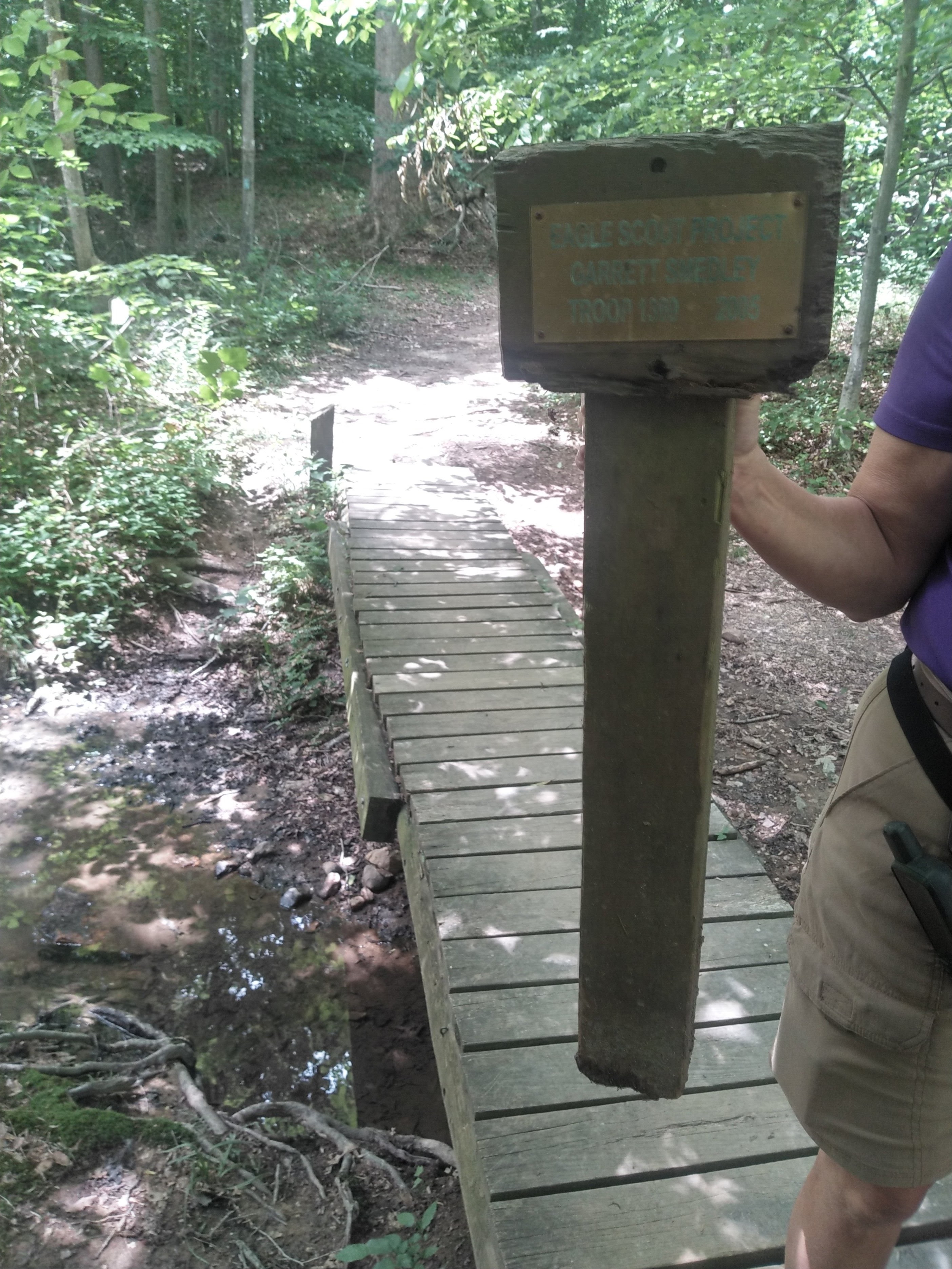
We crossed the creek on a new footbridge.


The new boardwalk is made of a composite material made to last for decades.


The Blue Tailed Skink or Five Lined Skink is a species of lizard that is native to the Eastern United States and parts of South-Eastern Canada. It is always a surprise to see that bright blue flash across your path.


As we continued along the boardwalk, we came to the Cabin Branch Pyrite Mine Overlook. During the mine’s operation, more than 200,000 tons of pyrite was brought to the surface and processed into sulfuric acid. The mining operation had a devastating effect on the surround landscape.


However, since the Park Service took over the restoration of the property in 1994, you can't even see where the mine was located, due to all the tree growth:


After we completed our history loop, we made our way back to the trailhead. While we didn't actually see a beaver, there is no doubt this tree stump was once gnawed on by a beaver. As it turns out, beavers were almost extinct and had completely vanished from Virginia in the 1890s. In 1950, two pairs of beavers were released in Mary Bird Branch and their population has thrived in Prince William Forest Park ever since. In the late 1990s, it was estimated that over 80 beavers lived in the park. One of them chomped this small tree.

Just as we were finishing our hike, two deer crossed our path. The older one, a female, bolted up and over the nearby hill. The younger one, a male, seemed curious and watched us from across the creek. The young buck had two little points atop his head.

We finished our hike with a picnic at the trailhead. We made it back in time to give Ruby a short walk before the afternoon thunderstorms pounded us with rain. We were glad we got an early start today.

It may be a few days before we can get back out to Prince William. Until then, stay thirsty my friends.

Monday, June 20, 2022

Hiking the Bull Run Occoquan Trail from Hemlock Overlook Park

Over a year ago, in May 2021, as we were coming out of our Covid hibernation, we camped down here at Bull Run Regional Park, where we are camped today, and decided to do a hike downstream along Bull Run to Hemlock Overlook Park from an overpass on Route 28.  On Saturday, June 18, 2022, we decided to pick up that thread from Hemlock Overlook Park and hike further downstream along Bull Run toward Bull Run Marina and Occoquan River, where we paddled a few days ago.

Directions to the trailhead were not clear, but we found it -- well marked -- at Hemlock Overlook Park, and started our hike:

 
The first half mile or so, we hiked down a connector trail along a drainage to the Bull Run Occoquan Trail itself:

The trail along Bull Run was beautiful on this not-so-hot summer day:

We had several spots where we could catch a pretty view of the stream:

The trail reveals the complex geology of this area.  While much of the bedrock is sandstone and mudstone, there are some dramatic outcroppings of granite and other hard rock:

After about 1.5 miles, we found this cache of kayaks and canoes, kept by Hemlock Overlook State Park for use by visitors:

After 2 miles or so, our trail left Bull Run and worked its way across a couple drainages and over some knobby formations:

We even spotted the decayed foundation of a cabin or other structure.  There wasn't enough remaining to give us an idea what type of building once stood here, but it was sizeable, and someone thought enough of it to construct a large stone foundation:

Several bridges crossed drainages that meander through this section of the forest land preserved in the various parks along Bull Run.  One of the bridges still had a (now fallen) plaque memorializing for us that this footbridge was constructed by Garrett Smedley as his Eagle Scout project in 2005 for Boy Scout Troop 1369.  While the bridge is starting to suffer from the ravages of time, it still stands strong after 17 years:

Surprisingly, our trail swung up-gradient and ran along a farm field for about a quarter mile, giving us expansive views of land and sky:

We eventually reached a small bay along Bull Run, upstream from the Bull Run Marina, where we encountered a young man who was bird-watching.  We waited politely for him to finish his scanning of the area and then sat down on a convenient bench to eat our lunch and admire our view of the widening Bull Run above its confluence with Occoquan River:

We even spotted a great blue heron fishing across a tributary of Bull Run.  He didn't seem to care that we were watching him:

On the opposite shore of Bull Run we spotted a pontoon boat with informal seats piled high on its boxy deck, moored at a simple dock on some private property:

Our lunch was over and we started our return up Bull Run.  As we reached that farm field again, we spotted some trail marker posts we hadn't seen as we hiked downstream.  The markers seemed to remind anyone who farmed the field that this edge of that man-made meadow was also reserved for people who just want to amble by without necessarily farming the ground:

As it turned out, our hike was just about 6 miles.  The weather was not too hot, so the hike was pleasant the whole way.  We were pleased to have a chance to get outside on our feet for an extended walk after a few weeks of excessive heat and rain.