Search This Blog

Sunday, March 26, 2023

Pohick Bay Red Trail

Sunday, March 26, 2023 

Hi Blog!

We are camped in Pohick Bay Regional Park. Pohick Bay is a Northern Virginia Park similar to Bull Run near Manassas. The park occupies a spectacular bayside setting on the historic Mason Neck peninsula in Fairfax County, Virginia. In early times, George Washington visited the area frequently. The area was also a hotbed of Civil War activity. Today the park features an 18-hole golf course, camping, an outdoor swimming pool, sailboat, pedal boat, canoe and sea kayak rentals, boating and fishing, miniature and Frisbee golf, four miles of bridle paths and 8-1/2 miles of nature trails. 

We had come to the Park in 2022 to paddle the waters of Pohick Bay, but hadn't hiked the trails.  After two days of rain, we were eager to explore our new neighborhood. We decided to hike the five mile red trail which would take us right along the shores of the Potomac River's Pohick Bay.

After being accused of stalking Dave, Kathy decided she would take the trailhead selfie!


Pohick is a Native American word that means “the water place.” NOVA Parks purchased 850 acres of land in the late 1960s, and by 1972 the park was ready to be opened. 

Several trails start from the parking lot off Pohick Bay Drive. Below, Dave points the way to the Red Trail:


After taking in the Cherry Blossoms on Thursday, we were eager to see if Spring has sprung in our neighborhood. Kathy stopped to check out the upturned roots of a fallen tree. She says you never know what treasure could have been buried under an upturned tree.


The ground in this area consists of sedimentary deposits of sand, clay and shell. It erodes fairly quickly. We climbed up hills and down into drainage valleys. Some of the valleys were wet and we needed to cross small streams. Below, Kathy prepares to walk a log bridge:


Since colonial times, the Potomac River watershed had been logged off several times. The park preserves dozen of trees including: Red Maple, Black Locust, Sweet Gum, Sycamore, Box Elder,  Ironwood, American Elm, Pin Oak, Scarlet Oak, Paw Paw, Sassafrass, Black Walnut, Black Gum, Weeping Willow, Black Willow, Hickory, Beech, Dogwoods, Wild Apple, Persimmon, Chestnut, Oak, and White Oak. We saw many of these species, but we couldn't identify them all. Since most of these trees are deciduous, they haven't leafed out yet. 
 
But, we can take a shadow photo in the middle of a forest!


We spent the first couple miles on the trail trying to find some sign of Spring. It wasn't until we reached the group camping area that we saw our first sign. Nothing says Spring like a single bright yellow dandelion!


This part of Virginia was settled in the late 1600's. As we hiked through the woods, we saw remnants of prior occupation. There were old mines and logging camps. This old saw table is still standing while the rest of the wood shed has since blown over.


While we didn't encounter much wildlife, there were birds everywhere. We noticed this nest right next to the trail.


Some of the trees in the forest have reached the end of their life expectancy. Mushrooms have taken hold on this pine tree.


The Virginia Bluebird Society, or VBS, was founded in 1996 to promote bluebirds and other native cavity nesters. VBS is affiliated with The North American Bluebird Society and is a Chapter of the Virginia Society of Ornithology. The VBS has placed dozens of birdhouses in the park.

We checked: no one has moved in yet this year.


As we mentioned before, this area sees a lot of erosion. Despite losing its footing due to an undercut bank, this American Holly is barely hanging onto the side of the drainage.


The trail took us right next to the 14th hole of the Pohick Bay Golf Course. The 18 hole course runs 6400 yards from the back tees, and features bent grass from tee to green with a mix of meadow grass. If we had more time in the area, we would have loved to play the course. 


As we mentioned before, several trees in the forest have reached the end of their life expectancy. This one has given up the ghost; only its neighbors hold it upright. These leaning trees are known as "widow makers." It looks like it is coming right for Dave!


After climbing up and down and up and down, we finally reached the shores of Pohick Bay. We heard what we thought were ducks. It turned out to be crows pretending to be ducks.


We almost didn't see this tiny turtle making its way down the trail. It saw us, though. and quickly hid inside its shell. Now you see me, now you don't!


There are several osprey platforms around the bay. The ospreys typically return to the area in Spring. The males arrive first and start nest building. So far, this site remains vacant.


Fort Belvoir is across the bay from our campground. It manages a waterfowl hunting program in Pohick Bay. There are a total of 26 blinds; each blind can accommodate 4 hunters. Not sure I would want to squeeze into that little box with three others.


After three and a half miles, we reached the scenic overlook at Fishing Point. Just below where Kathy is resting in the photo below was a fisherman trying his luck.


By this time, we had almost given up finding Spring --- when, all of a sudden, we noticed these little blossoms pop out. Spring has sprung!


Now that Spring had sprung, it was easy to see more signs.

There is more rain in the schedule for tomorrow, so this may be our last outing in Pohick Bay. We move up to Clarksboro, New Jersey on Tuesday. Until next time, stay thirsty my friends!

Saturday, March 25, 2023

Cherry Blossoms!

Better to be lucky than smart, they say.  Oh, yes!  When we planned our itinerary back up to the Philly area from Florida, we were sure that we would be arriving in the D.C. area too early for the cherry blossoms.  Well, climate change, which seems to be bringing Spring early everywhere (daffodils two weeks early, for goodness sake) --- 


-- blessed us with early cherry blossoms in Washington, D.C., and it turned out that our free day to visit the Tidal Basin was the very day the blossoms peaked.  Not only that, but the rainy forecast magically turned to sun.  So, as we said...

After running an errand, we drove over to the local Metro stop and rode in to the L'Enfant stop, aiming to have lunch on The Wharf before walking over to the Tidal Basin to see the blossoms.  It was a cheery, breezy, sunny day on the waterfront:

We happened to pass by Union Stage at Pearl Street Warehouse, and, who should be shown on the marquee for an upcoming performance but Barenaked Ladies!

 
It called to mind our 1996 trip to Boston with our kids and good friend Darla, where Darla and Kathy obligingly posed for a lighthearted photo -- not knowing it would echo down the years:

We had a scrumptious lunch on an outside veranda, then walked over to the Tidal Basin, where this was our first look at the cherry blossoms:

It seemed everyone and everything were coming out here today, including these beautiful little residents sitting quietly on one of the trees along the basin:

We always enjoy returning to Washington, D.C. to walk as far as we have time, and to see our favorite monuments and memorials in ever-new perspectives.  This was the Jefferson Memorial in pink-and-white splendor ---

--- and this the Martin Luther King, Jr. Memorial surrounded by admiring visitors and admired flora:

These were the best photos we have to share from the day.  We might have taken more, but we were too busy admiring the beautiful blossoms and people.  Everyone at the Tidal Basin was in glorious humor and unfailingly polite to each other, enjoying this burst of sunny weather and the peak of the season.

Happy Spring!


Tuesday, March 21, 2023

Raven Rock State Park

Monday, March 20, 2023 

Hi Blog!

This stop in North Carolina has been all about exploring different state parks. Near the geographic center of North Carolina is Raven Rock State Park, a 4,600-plus acre natural area that offers a variety of outdoor activities. We really enjoyed our visits to Eno River and Cliffs of the Neuse, so we were eager to visit one more North Carolina State Park before leaving the area on Wednesday.


Raven Rock offers over 30 miles of trails to explore on foot, bike or horseback. The park is split in two by the Cape Fear River. The north side contains the bridle trails while the south side has the hiking and biking trails. We planned several out-and-back hikes to see various parts of the park.


The first trail we took was the Northington Ferry Trail. We followed an old wagon road as it made its way down toward the Cape Fear River. We stopped for lunch at a convenient bench and noticed someone created a balanced rock on a nearby stump. Kathy tried to create one next to it and managed to make a mess. This is the original rock art:


[Ed: We did not take a photo of the mess. However, we did meet the artist of the original art above, as she made her way back up the trail from the river. She noticed her art work was in shambles. Kathy apologized profusely. The artist took it in good humor and said she would recreate her work.]

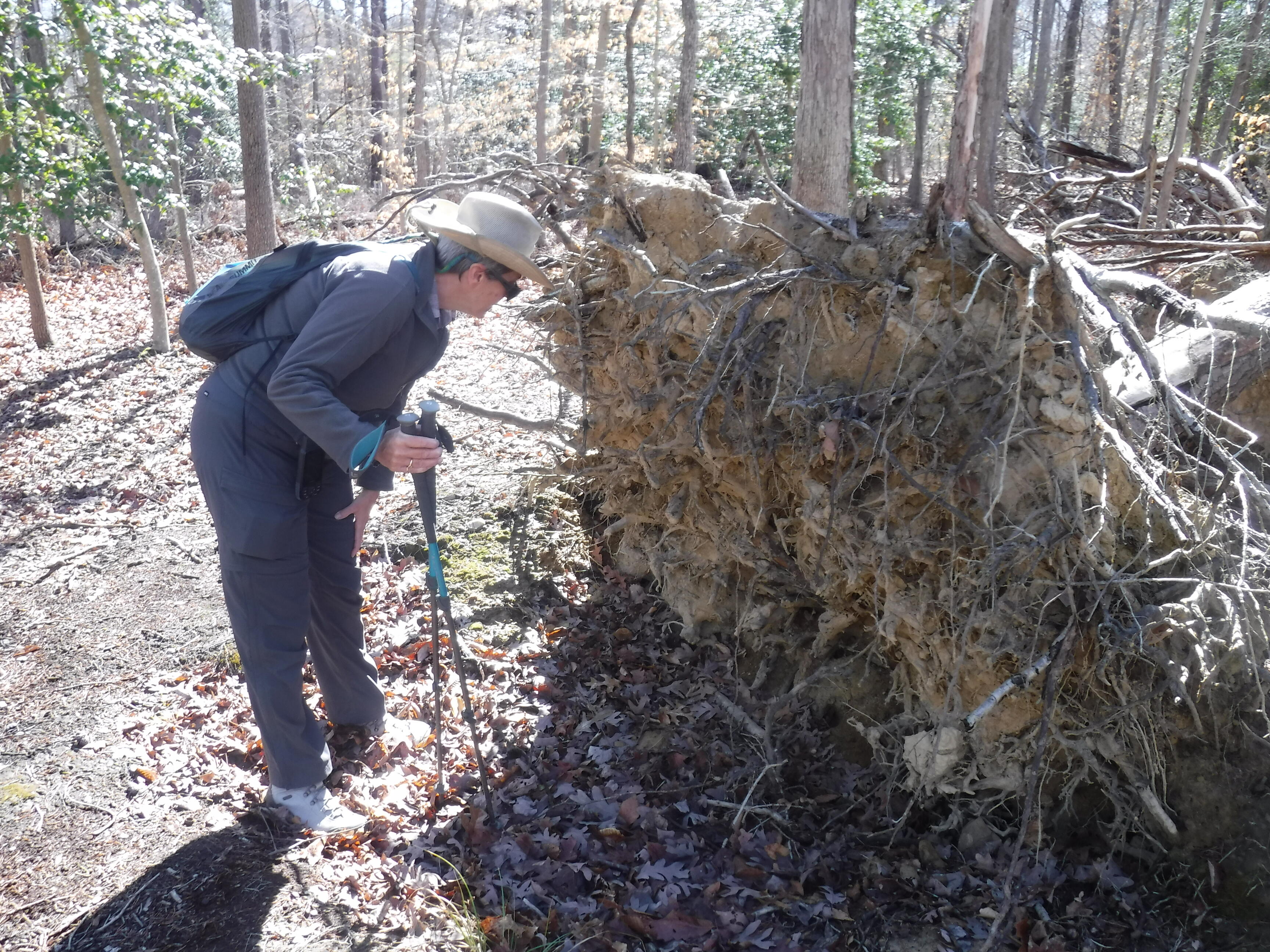
As we worked our way to the site of the old ferry, we had to cross a small drainage. The ferry was part of a road that stretched from Raleigh to Fayetteville and crossed the Cape Fear River via the Northington Ferry and served as the area's major transportation route. 


With no way to make it across the river, the road came to an end.


Unfortunately, there was no bridge over Campbell Creek, so we had to make our way back up the old ferry road to continue our explorations.


Today may be the first day of Spring, but with temperatures in the 40s, it didn't feel like it. However, we did see some small signs that winter is leaving.


The next trail we tackled was the Fish Traps Trail. As we made our way back down toward the river. We hiked over rocks formed more than 400 million years ago by intense heat and pressure.


Before Europeans arrived in the 1700s, the indigenous peoples, Sioux and Tuscarora Indians, lived and hunted in the area.  They used the channels between the rocks to set their fish traps.


Locks and dams were built along the river to facilitate navigation by boat. Raven Rock became an important landmark for river pilots. After a hurricane destroyed the locks and dams in 1859, the structures were not replaced; railroad transportation eliminated the need for river travel. As new roads were built, the ferry was closed and Raven Rock became a popular recreation spot.

The remnants of the Northington lock and dam can still be seen from our vantage point.


Pictured below are some amazing quartz erratics that decided to roll in to decorate the trail.


We often see felled trees along the trail. Sometimes we'll stop and count the rings. This is the first time we've ever seen a figure 8 core. Here, two young trees grew up next to each others. The larger, center tree, just absorbed its smaller neighbor.


As we hiked toward the fish traps, there was a family hiking in front of us. They stopped at this tree and hid a small paint rock. For the little boy's sake, we pretended we didn't see it.


On our way back up the trail, we stopped to check out the rock. The rock comes from Northeast Ohio Rocks and started its journey in April 2017. We will post our photo and location on their Facebook page. We put the rock back for the next family to find. In fact, we gave a hint about the rock to the next family we passed.


Raven Rock State Park is situated along the Fall Line, where the hard rock of the North Carolina piedmont transitions into the softer rock of the coastal plains. The site’s most prominent feature, and that which gives the park its name, is the 150-foot cliff that runs more than a mile along the Cape Fear’s southern bank. Originally called Patterson’s Rock after one of the area’s early settlers, it was renamed Raven Rock in the mid-1800s because of the large numbers of black birds that perched atop the ledges.

Since we had visited Raven Rock in 2018, we decided to call it a day and get back to camp so Ruby could have her afternoon walk. If you are curious about the views from Raven Rock, click the link to our 2018 blog, which this photo is from:


We finished our hike with a nice walk through the hardwood forests that surround the Cape Fear River. Mountain laurel shows the way.

It's going to be a busy couple of weeks as we get ready to purchase a sticks and bricks house, so our blogs will be unpredictable and spotty; but never doubt that we are thinking of all of you and your own adventures!

Sunday, March 19, 2023

Cliffs of the Neuse State Park

When we arrived here, east of Raleigh, North Carolina, we did not know that we were close to the Neuse River, which we had pedaled, first in 2018, and then again in 2022.  We knew it from those visits as a pleasant river running through suburban areas, but not as a wild river.  Looking for a hike this visit, we discovered Cliffs of the Neuse State Park, and it reminded us of our earlier visits.  However, reading about the cliffs along the Neuse River in the state park, we realized that there might be more to this river than we had realized.  So we headed off to put our boots on the ground and rediscover the river and its wild habitat:

 
We started our hike on the 350 Yard Trail, which led us across the top of the cliffs on the river:

 
Sure enough:  this was a different Neuse River than we had known.  Here, on these cliffs, there was no human structure in sight:

 
While not wilderness in the technical sense, because there is so much farmland in the area, nevertheless, the land around the river resembles wilderness and produced a wonderful hiking experience:

 
Today was Sunday, so there were visitors in the Park, but they were few and far between.  We spotted a few, down below on a beach along the river:

 
As we hiked further along the river, we descended to the banks and found visitors of another kind along the water's edge -- cypress knees!  We were a little surprised to see cypress this far north, and it brought back wonderful memories from our recent outings in Florida, Georgia and South Carolina.

 
The river flows peacefully through the park, and we enjoyed a pause to watch the breeze blow the branches of trees over the riverbanks:

 
Our hike was up-and-down.  Here we looked down a flight of wooden railroad tie stairs toward a string of boardwalks toward a freshet and a trail junction:

 
The trails in the park are well constructed and well maintained.  Here, an observation deck off the trail to the left allows a look down onto the freshet and the trail on the right:

 
In certain places, the park staff have built simple, traditional fences, and, where the fences have fallen into disarray, found small fallen tree trunks nearby to slip into the post-and-rail assembly and keep the fence maintained:

As we hiked, we followed the freshet upstream toward the main lake in the park.  We found one pretty little cascade as we neared the lake:


Turning a corner, we reached the lake's spillway, and then the lake, where we found a convenient bench and ate our lunch --
 

-- enjoying the gentle spectacle of the first apple blossom blooms, which have erupted even before the first green leaves of the surrounding deciduous trees:
 
 
After a small picnic lunch and a healthy drink of water, we continued on our way.  In the uplands above the lake, we spotted this tree with three curious burls, which were curious because of their very smooth surfaces:


The rest of our hike was uneventful; we solved all of the problems of the world, said a few hellos to other hikers, and generally enjoyed the sights, sounds and smells of early Spring.  Kathy spotted this little one on the trail just in time to avoid scaring it off before David could get a photo:

This was a short hike -- only four miles.  But it fit the time we had today and provided a nice stretch of the legs to prepare for a longer hike tomorrow, in yet another state park.