Search This Blog

Sunday, November 20, 2022

Rappahannock Canal Path 2022

Saturday, November 19, 2022

Hi Blog!

It's been a while since our last blog post. We had a very busy week in South Jersey visiting with family in the Philadelphia area. On Wednesday, we moved the RV south to Fredericksburg, Virginia in hopes of avoiding cold weather, while still being within driving distance of Philadelphia for Thanksgiving. Unfortunately, Mother Nature had other plans. With lows expected to be in the teens here in Fredericksburg, we busted out the cold weather gear, flannel sheets and electric space heaters! At least we won't have to deal with 12 inches of snow like we did in January!

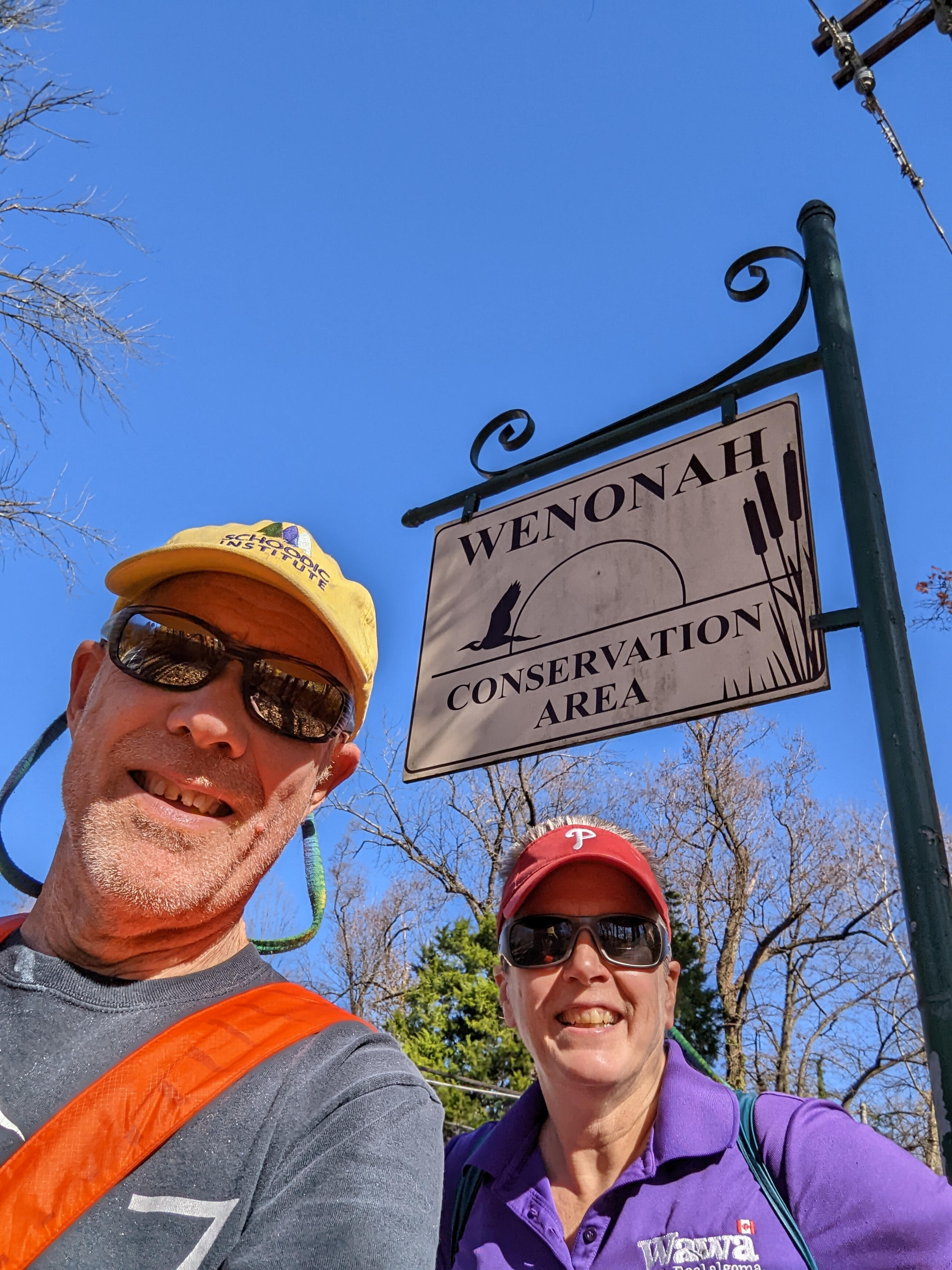
It took a couple days to get settled, but by Saturday, we were ready to get out and stretch our legs. We've stayed in Fredericksburg before, so we are familiar with the area.  Last December we had hiked along the Rappahannock River Heritage Trail to Embrey Dam.  You can click the link if you are curious about that section of the trail. For this hike, we decided to follow the Canal Path loop. We tried to take a selfie when we started the hike, but it didn't turn out. So, I just borrowed this picture from last December's blog.


The Canal Path is a paved pathway that, at 1.8 miles long, combines with a 1.7 mile section of the Heritage Trail to make a 3.5 mile route.  It winds along the canal from Fall Hill Avenue to Princess Anne Street. Since many of the trees have lost their leaves, it was easy to see the water level in the canal.


The Canal Path runs along the border of the University of Mary Washington. UMW is a public liberal arts university founded in 1908 as the Fredericksburg Teachers College. The institution was named Mary Washington College in 1938 after Mary Ball Washington, mother of the first president of the United States.

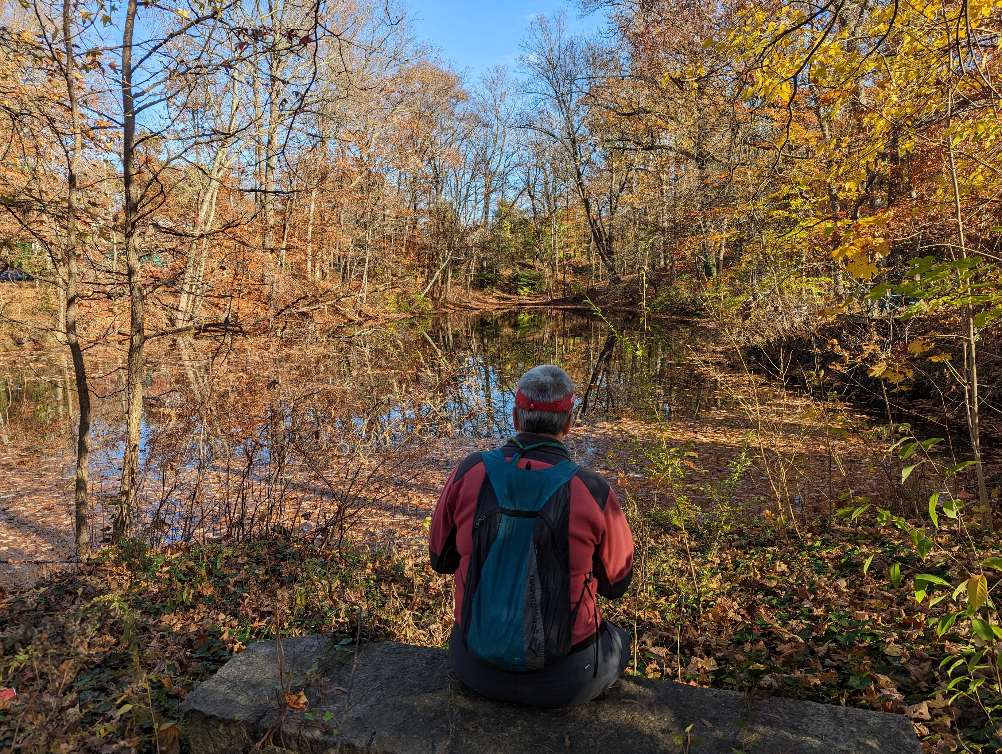
We stopped at Gayle's Pond to admire a couple of duck families.


As the day warmed up, more and more folks came out to enjoy the trail. The dog park was full of playful puppies. However, two local tom cats were having a dispute over the best hunting grounds along the banks of the canal.  They were dressed in a collar and a bandana, so we estimated that they lived in the neighborhood and probably know each other.  Familiarity breeds contempt.


As the canal approached the Rappahannock River, the path crossed to the opposite side of the canal.


This section of Fredericksburg is known as the Old Mill District. It dates to the earliest settlers along the Rappahannock River. Pictured below are the remains of the Meyers & Brulle’s Germania Flour Mill.
From the mid-1800s, this mill produced up to 100 bushels of flour per day. 


We left the Canal Path and started up the Heritage Trail. Along the way, we followed a Story Walk. A story walk is basically a children's book taken apart and its pages posted on signs placed along a path. Families can walk from the start of the book to each page and read as they go. The current book on display is What Can You Do With A Rock? Needless to say, Kathy read all 12 chapters!


We took a short side trip off the Heritage Trail to check out the Old Mill Park.


Old Mill Park features soccer fields, picnic shelters, a playground, restrooms and riverfront views. We decided to walk down to the banks of the river and came across this monument with a quote from Master Hsing Yun, a Chinese Buddhist monk. 

May palms be joined in every world in kindness, compassion, joy and giving.
May all beings find security in friendship,peace and loving care.
May calm and mindful practice seed patience and equanimity deep.
May we give rise to spacious hearts and humble thoughts of gratitude.

By Venerable Master Hsing Yun


The park protects the remains of the Washington Woolen Mill.  The mill served as a hospital during the Civil War.  Notably, the mill employed more female workers than any other business in Fredericksburg at the time, and Clara Barton worked there after the Union army turned the structure into a hospital in 1862.


As we continued along the trail, we passed several works of art. The Fredericksburg Art Commission sponsors a public sculpture project.  Aman is a Siouan word that means place, environment, or country, and appears throughout the language spoken by Mahock/Manahoac. 


Morning Glory Bench takes morning glory flowers as inspiration. Benches are playful art objects that invite interaction with the passer-by. This "whisper bench" has great views of the Rappahannock River, along the Heritage Trail. You can whisper into one blossom and your seatmate can clearly hear you at the other!


Several Native American tribes occupied the area surrounding Fredericksburg around the time that John Smith was exploring the rivers and the Chesapeake Bay.  Supposedly, the tribes used certain indigenous plants to mix poisons for hunting, creating shallow “bowls” carved into rocks near the river.  


One such carving, known as the “Indian Punch Bowl,” was discovered and given this specific name by Major Francis Thornton, who inscribed the stone in 1720.  The Thornton family opened several of the original mills located in this section of the Rappahannock River.  Thornton often hosted large parties on his property along the river, and supposedly served punch to his guests from the rock, thus lending it the name “Indian Punch Bowl.”


The Rappahanock River tumbles out of the Virginia Piedmont and drops 25 feet over a distance of one mile. For more than two centuries, industries in this transitional zone used this natural energy. As we finished our hike, we enjoyed the sights and sound of the river rapids.


After four miles of hiking and exploring, we built up powerful thirsts. On the way back to camp, we stopped at one of our favorite breweries - Stangeways. With 34 taps, there are plenty of great beers to choose from. One feature we like is the way they color code their menu based on beer style. So, if you like lighter beers, pick from the yellow column. If you want dark, high alcohol concoctions, pick from the brown column.


We each picked four we were interested in sampling. Tiramisu (porter), Ape Armageddon (imperial stout), Lore of the Land (barleywine), Turbogenerator (doppelbock), Gingerbread Gourd of Thunder (pumpkin stout), Stand with Ukraine (golden ale with beet sugar), Monks Indulgence (Belgian triple) and Barrel aged Monks Indulgence (bourbon barrel aged triple).


 We had fun tasting and re-tasting to pick our top four to bring home with us. The winners were Ape Armageddon, Gingerbread Gourd of Thunder, Stand with Ukraine and Monks Indulgence.

And, so ends another adventure in the life of Dave and Kathy intrepid RV explorers!

Wednesday, November 9, 2022

Wenonah Lake Trail

Two days ago, we hiked the Mantua Creek Trail in the Wenonah Conservation Area.  We've had such a great string of unseasonably warm and sunny weather that we had another great hiking day today; so we decided to return to Wenonah Conservation Area to hike the other direction on the Wenonah Lake Trail:

The Borough does a good job of maintaining the trail signage and is attentive to trail maintenance.  Along our way, we spotted this beautiful signage:

Setting out on the trail, we noted that Fall color still predominates, although the trees are getting more bare with each passing day:

Our trail followed up Break Back Run, a tributary of Mantua Creek, toward Wenonah Lake.  The run inhabits a broad wetland that is the bottom of an old stream valley:

Extensive work has been done to construct boardwalks over wet areas and along difficult cliffside stretches.  Even so, the numerous small streams feeding Break Back Run have created steep crevices we had to cross, up and down and up again, as we made our way upstream:

 Some of the boardwalks had unique character!

At one point, we spotted a small boardwalk leading to a viewing or sitting platform.  On closer inspection, we realized the small boardwalk was posted as private property.  It had been constructed by a neighboring landowner to provide access to enjoy the stream and wetlands near the trail:

Eventually, we reached Dilks' Pond, a private pond near Wenonah Lake.  We initially mistook it for the larger lake and took this photo of Kathy gazing out at it.  Soon after, we realized that Wenonah Lake was a little further on and significantly larger.

Wenonah Lake is a former millpond that was created in 1762 by Abraham Dilks to power a gristmill on Break Back Run. At that time, it was known as Dilks' Pond (we're not sure what the present-day Dilks' Pond was called at that time).  The mill operation lasted through succeeding generations until the late 1890’s.  The pump house for the newly formed Wenonah Water Company was constructed on the site. Just before the First World War the company deeded the lake to the Borough of Wenonah. Since that time it has been the primary recreation area of the community and is run by the Wenonah Lake Association. Old timers still call this Warner’s Lake, named after Joseph Warner who conducted an icehouse and creamery next to the lake.

As we hiked around the lake, we noted a great deal of beaver signs -- gnawed trees and such -- but no beaver or lodge.  We surmised that beaver had been active until perhaps a couple years ago, and perhaps the beaver was relocated.  The damp wetland encouraged significant growth of fungi on old trees:

The lake is beautiful in its autumn colors, even with tree branches starting to be stripped of their foliage:

As we said, we saw no beaver.  We did see two large, healthy looking deer but were not able to get a photo of them.  However, we caught these three geese in peaceful repose in the middle of the lake:


Lake Wenonah has been improved with a day use area, including a small beach and diving platform.  It was closed for the season, so no one was present as we passed:


The entire hike was only about 2 miles, but it was quite difficult, with many steep ups-and-downs, slippery leaves hiding the trail, and treacherous roots everywhere.  It turned out to be quite an unusual and interesting trail despite its short length.  We're hoping we can keep up this unbroken record of finding interesting hikes in this area of South Jersey until we leave for Fredericksburg, Virginia next week.  We'll keep you posted on the results!

Monday, November 7, 2022

Wenonah Conservation Area

Monday, November 7, 2022

Hi Blog!

After a weekend of family visits, it was time to hit the trail again. Kathy just picked up new orthotics for her day hikers, so we were looking for a short hike, perhaps around a small lake or along a stream, to break them in. We turned to All Trails, as we often do when looking for local hikes. We came across the Mantua Creek Trail in the Wenonah Conservation Area.

We found the trailhead parking, but were a little confused as to which way to go from there.


We decided to check out the kayak launch just in case we get a chance to come back and paddle. This area was once the location of several boat landings for area farmers to ship produce and lumber to the Philadelphia market. This activity started before the Revolutionary War and continued for over one hundred years. It's hard to imagine how busy this area must have been.


The Wenonah Environmental Commission is a specialized branch of the Wenonah, New Jersey borough government which is charged with preserving Wenonah's unique natural resources for the enjoyment of local residents (and us).  WEC manages 135 acres of conservation land, which is over 21% of the borough's land area.  Within these areas, the borough maintains over six miles of hiking trails, including 40 bridges over various bodies of water.


As most of you know, Kathy is crazy about berries. We actually came across a berry we have never seen before, the American Strawberry Bush. This bush is a native woodland plant found in forested or woodland areas as an understory plant and often in swampy areas. It has very unusual flowers and even more unusual fruits. In late spring or early summer 5-petaled creamy yellow-green flowers appear that then develop into very showy pinkish-crimson ball-shape, strawberry-like bumpy pods that burst open to reveal bright orange berries while the green foliage morphs into a yellowish green shade and finally turns to shades of pink and red. We found several of these bushes and they were each putting on a show.


We lost count of the number of bridges we crossed, but here is one that covered a really deep canal.


We stopped at the rest area on Clay Hill. In 1861, the West Jersey Railroad extended their line from Woodbury to Glassboro. The Mantua Creek was crossed at this point. In 1871 the railroad tracks
were moved further upstream.


From Clay Hill, we took in a local art installation. We are not sure of it's official title, but we named it "The Lost Chairs of Mantua Creek."


Mantua Creek drains over 50 square miles of Gloucester County. From its headwaters near Glassboro, Mantua Creek flows northwest for 18.6 miles to the Delaware River at Paulsboro. In this section, the creek flows through gently rolling, wooded terrain marked by a number of small lakes. 


During the Revolutionary War there was a skirmish between the county militia and a British foraging party in this area. We saw no foragers today.


However, we did see this little snake snaking his way across the trail.


The weather has been so warm, we could almost believe it was summer if it weren't for the falling leaves.  Even the trees were wilting in the heat!


We soon came out to a clearing. The trees in this section looked like they were barely hanging on. As it turns out, in August 2021, Hurricane Ida spun up a tornado that uprooted trees along a section of the trail. It was estimated that the town of Wenonah lost over 800 trees.


As we crossed under the "new" railroad trestle, we came upon a fisherman hauling in his latest catch. It was his 10th fish. This time of year, they are just gobbling up tiny worms.


At this point in our hike, we left Mantua Creek, following the railroad right-of-way and headed over to the Monongahela Brook watershed. The fall colors were popping.


This trail parallels the Monongahela Brook, crossing over an embankment and then a 100-foot long Bog Walk which traverses the site of the former Greene’s Lake. Sections of the Monongahela Brook Trail were originally part of a trail used by Native Americans.


After two miles of hiking, we decided to make Comey's Lake our turnaround point. In 1890, Camel’s Back Run was dammed up by the Wenonah Park Association creating a lake and picnic area for the new town of Wenonah. 


Title passed to Roberty J. Comey and he further developed the property. This area was dedicated as a conservation area in the 1960’s. Some of the largest oak and tulip poplar trees in the town are in this wooded area. A Tea House, amphitheater and a remnants of the old bridge over Camel’s Back Run, were all features of the Robert H. Comey Estate.


The beautiful image below was brought to you by accident. As we started our return trip, Kathy began working on a haiku to include in the blog. She was so busy ruminating, that she missed the turn to the Monongahela Brook Trail and started up the George Eldridge Trail. Eagle eye Dave noticed houses in the distance that we hadn't passed on the way. A quick check of the GPS confirmed that we missed a turn. On the way back, we stopped at the lower bridge of Monongahela Brook to snap this photo.


Back on the correct trail, Kathy spotted the blue heron she had seen earlier in the day. This time, the late afternoon light was just right to catch a photo.


A deer did cross our path, but she was too quick for a photo. However, these ducks were more than happy to pose for us.


We leave you with the haiku that almost got us lost:


Nuts cover the trail.

Footsteps crunch, the hikers prevail.

Scurry, squirrel, time's short.