Search This Blog

Thursday, March 29, 2018

Getting Out and Around in Hatfield

Hi Blog!

It's been a few weeks since we posted a blog entry. We've spent most of the last couple weeks working our way North in order to get back to the Philly area in time for Dave to serve his Jury Duty. To answer your burning question, no, Dave did not get picked. He was called to a panel, but they filled the jury before they got to him. Now that duty has been done, it was time to turn our attention to getting out and about again.

We decided to make the most of the most recently nor'easter by heading up to Jack Frost for some spring skiing.


Jack Frost was always our go-to ski mountain. Our extended family spent many a winter day schussing down Frosty, Powder Puff, Ridge Run, Easy Rider and, the most dreaded - Jane's Lane!


We really got lucky with the weather. The recent snow was groomed into powdered corduroy. We practically had the place to ourselves.


The recent cold snap has given way to warmer and wetter weather. We probably won't get another opportunity to ski while we are here. However, we are looking forward to getting in a round or two of golf once the weather improves.

Because today was forecast to be rainy, we were looking for an indoor driving range in hopes of working on our swing. As we searched, we came across an indoor golf course called Play-a-Round Golf. You can virtually play over 70 different famous courses. With so many to pick from, we decided to try the oldest and most famous - The Old Course at St. Andrews!


The Old Course at St Andrews is considered by many to be the "home of golf" because the sport was first played on the Links at St Andrews in the early 15th century. Golf was becoming increasingly popular in Scotland until in 1457, when James II of Scotland banned golf because he felt that young men were playing too much golf instead of practicing their archery. The ban was upheld by subsequent kings of Scotland until 1502, when King James IV became a golfer himself and removed the ban.


We probably should have picked an easier course for our first time out this year.  We never made it to the Swilcan Bridge.  Spanning the first and 18th holes, the bridge has become one of the most famous icons for golf in the world. Everyone who plays the 18th hole walks over this 700-year-old bridge, and many iconic pictures of the farewells of the most iconic golfers in history have been taken on this bridge.

After two hours, we made it to the 10th hole. We congratulated ourselves for both shooting 74, which was just under double par! (Lots of room for improvement...) 

Time to celebrate at the 19th hole!


After lunch, we decided to give another indoor sport a try!


The computerized scoring makes the game go much faster.


While we sported the day away, the misty weather moved on. By the time we got back to camp, we were greeted with a little sunshine and 68F weather! Baxter wasted no time getting out and enjoying it!


The next few days will be filled with more chores and family visits. Stay tuned!

Monday, March 5, 2018

Peddling the Neuse River Trail

The Neuse River Trail is a 33-mile paved greenway located in the Research Triangle region of North Carolina, running along the banks of the Neuse River from Falls Lake Dam, north of Raleigh, to the town of Clayton, south of Raleigh.

The Neuse River Greenway trail is part of the Capital Area Greenway trail system as well as the Mountains-to-Sea Trail that crosses North Carolina from the Great Smoky Mountains to the Outer Banks. Open to both cyclists and pedestrians, the Neuse River Trail is the longest greenway trail in North Carolina and the longest paved trail between northern Virginia and western Georgia. 

The Neuse River Trail is also part of the East Coast Greenway, a 3,000 mile long biking and walking route linking the major cities of the Atlantic coast from Calais, Maine, to Key West, Florida. The spine route and branching complementary routes are for non-motorized human transportation.  The nonprofit East Coast Greenway Alliance was created in 1991. The entire route has been selected. As of July 2017, 900 miles, or 32% of the route, is off-road on traffic-protected greenways. The vision is for the entire trail to be off-road.

The weather today was bright and cold, and it was perfect for biking as long as we dressed warmly.  We drove the 12 miles from Four Oaks to Clayton to hop on our bikes:


While the main part of the trail follows the Neuse River over what appears to be an old railroad right-of-way, there are a number of side trails that extend from the main trail into nearby neighborhoods.  We parked at the Sam's Branch Greenway parking area, up the Sam's Branch Creek from the main flow of the Neuse River.

About a mile on, we joined the main trail, but on the way we passed a new housing development:


Areas along the trail appear to have been improved by local communities or nonprofit groups.  We passed a Butterfly Garden:


We also pedaled along a fence decorated by school kids in colorful, artful fish:


The trail also boasts a number of explanatory signs that discuss the forests and wetlands through which the trail runs:


The trail also boasts several bridges for pedestrians and bikes.  The bridges are well-built and attractive:


The Neuse River itself is not particularly dramatic or attractive.  It runs slow and brown.  We could imagine, however, that, once Spring has come, the banks would be green and splashed with the color of blossoms.  But not now:


The construction work on the trail is impressive, and more sophisticated than many of the trails we have ridden:


We ran into one detour, where construction workers were rebuilding a bridge that had been damaged by a storm in 2017:


We thought most of the trail would slog through suburbia and commercialburbia, but we were wrong.  Most of the trail winds through forest and wetland, with no sound or sight of houses, buildings or traffic.  Some sections, such as the stretch toward the end of our ride, wind through beautiful farmland:


The Capital Area Greenway Trails are far more extensive than we've had time to explore on this stay.  But the availability of all this bicycling, together with the other hiking and paddling opportunities in the Raleigh area, may lure us back for a longer stay the next time we pass through North Carolina.


Sunday, March 4, 2018

Raven Rock State Park

Hi Blog!

We are working our way north so that Dave can meet his jury duty requirement on March 20th. We are currently camped in Four Oaks, North Carolina. We are trying NOT to go north too soon, since the Philadelphia area is being hammered by snowy, icy nor'easters. We have a couple days here to explore. On Sunday, March 4, 2018, we drove over to Raven Rock State Park to do a little hiking.


Raven Rock State Park sits along the fall zone, an area where the hard, resistant rocks of the Appalachian foothills give way to the softer rocks and sediments of the coastal plain. The underlying rocks of the area were formed more than 400 million years ago by intense heat and pressure. Through the ages, flowing waters and swirling winds gradually eroded the land, carving and sculpting Raven Rock. We looked forward to getting up close to these ancient rocks. But first, we needed to traverse the hardwood forest that surrounds the Cape Fear River.


From an overlook, Kathy peers down upon the Cape Fear River. It's been a long time since we've been this high. We've just spent the last couple months in the coastal planes of Texas, Louisiana, Florida and South Carolina.


The Sioux and Tuscarora Indians hunted this area until European settlers arrived in the mid-18th century. The first settlers were primarily hunters and trappers who were searching for high country similar to their homeland, Scotland. Later, stores, mills and quarries were built. Many of the woodlands were farmed, and as the forests returned, much of the land was harvested for timber. In the rapids pictured below, the early settlers set up fish traps.


As we continued to hike down to Raven Rock, our attention was drawn to this unusual tree.


Raven Rock is a 150-foot high and one mile long crystalline granite rock formation along the Cape Fear River. In order to appreciate the sheer size of the rock, it is best to climb down to the base. Can you see Dave on the stairs below?


Raven Rock is part of the Piedmont, a formation of metamorphic, sedimentary, and igneous rocks created through the crushing blows of mountain-building continental collisions, the erosion of mountain chains, and the pulling apart of a super continent. The tiny folks in the photo below are looking up at over 400 million years of history.


Life hangs on, even in the most unlikely of places.


Bundled against the cold, Kathy takes in the immense outcrop.


Before long, we reached the end of our side trail and it was time to start climbing back up.


We decided to take the Little Creek Loop Trail in order to log a couple more miles before lunch. This beautiful little woods walk took us all along the banks of Little Creek, which burbled along granite rock shelves, producing pretty little cascades and pools.


Our final adventure took us right down to the banks of the Cape Fear River on the Fish Trap Trail. Just beyond the rapids where the fish traps where set, lies the remains of the old Northington Lock and Dam. After a hurricane destroyed the locks and dams in 1859, the structures were not replaced; railroad transportation eliminated the need for river travel. As new roads were built, the ferry was closed and Raven Rock became a popular recreation spot -- for which we are eternally grateful.


By connecting these trails, we ended up hiking over six miles. All that hiking builds up a powerful thirst that only local craft brews can quench. We decided to do our quenching at Double Barley Brewing in nearby Smithfield. We were drawn to this place by all the good reviews on Trip Advisor. However, good beer is subjective. It was our duty to sample all their brews and decide for ourselves.


There wasn't a bad beer in the bunch. However, we have a tiny RV and, unfortunately, could not take them all home with us. We filled a couple growlers with Sparkys - a coffee, chocolate, milk stout. We also picked up a couple specialty bottles including a belgian holiday ale and Thrilla in Vanilla, plus a couple four packs - barrel aged Steakcake Stout and Gourd Rocker Imperial Pumpkin Porter!  Kathy couldn't resist showing off her treasure as we got out of the Jeep back at our campground:


If you are traveling up the I-95 corridor in North Carolina, make time to stop at Double Barley Brewing, in Smithfield. After talking with the owner, they plan to join Harvest Host and are looking forward to RVers boondocking in their parking lot!


Friday, March 2, 2018

It Is a Wild Life in Sewee!

The Sewee or "Islanders" were a Native American tribe that lived in present-day South Carolina in North America.  In 1670, the English founded the coastal town of Charleston in the Carolina Colony on land belonging to the Sewee. The town flourished from trade with the Sewee and neighboring tribes.

Sewee now refers to an area along the South Carolina coast just north of Charleston.  It is part of the tidal lands that are also known as the Low Country, which includes South Carolina's coast and adjacent Sea Islands. Once known for its slave-based agricultural wealth in rice and indigo that flourished in the hot subtropical climate, the Low Country today is known for its historic cities and communities, natural environment, cultural heritage, and tourism industry.

When we decided to camp at the Buck Landing Recreation Area in the Francis Marion National Forest, we anticipated opportunities to paddle and hike.  There are many of those.  But we were surprised to find how much wildlife the area harbors.

The first place we stopped to learn about local wildlife was the Sewee Visitor & Environmental Education Center, which features displays about the various ecosystems, wildlife and heritage of the South Carolina Low Country. Exhibits include the marine ecosystems of the Cape Romain National Wildlife Refuge and the ecosystems in the adjoining Francis Marion National Forest. The Center is jointly operated by the U.S. Fish and Wildlife Service and the U.S. Forest Service, and offers nature education programs and activities.

One of the more interesting exhibits at the Sewee Visitor Center was its red wolf center.   The Sewee Center is home for four endangered red wolves, which are housed at the Sewee Center for observation, education and breeding.


These captive wolves help to ensure the genetic diversity of the species.  With a population of approximately 200, the red wolf is one of the most endangered animals in the world today. Originally, the red wolf roamed as far north as Pennsylvania and as far west as central Texas. Like its relative the gray wolf, the red wolf was extirpated from its former range by large scale predator control programs. By the late 1930s, only two populations are believed to have remained; one in the Ozark/Ouachita Mountain region of Arkansas, Oklahoma, and Missouri, and the other in southern Louisiana and southeastern Texas. Nearly extinct only a few decades ago, the red wolf recovery program began with the help of captive breeding and reintroduction programs.

On May 21, 2013 a male and female arrived at the Sewee Center from the captive facility at Alligator River NWR. The male sired six pups at the Sewee Center on April 8, 2014. One male remains at the Sewee Center and is paired with a female for breeding. Cape Romain’s nearby Bulls Island has played an integral role in the recovery of the endangered red wolf. Due to its protected geographic location and prey base, Bulls Island was chosen as an experimental release site. In 1978, the 9-month successful release of two wolves demonstrated the feasibility of reintroduction into the wild. Bulls Island became the first island breeding site in 1987. The island breeding program closed in 2005. From 1987 to 2005, 26 pups were born at Bulls Island.

We walked out to watch the red wolves.  On our way back, we used a boardwalk through a swampy lowland, and chanced upon this little guy sunning himself on a dead tree branch:


After visiting the Sewee Center, we drove out to the Garris Public Boat Landing in the Cape Romain National Wildlife Refuge, which is a short ferry ride from Bull Island.  There, we saw all sorts of waterfowl, including this snowy egret who was concentrating on his fishing:


While we had hoped to take our kayaks out onto Sewee Bay and paddle the wetlands and channels near Bull Island, today proved too windy.  So we decided to see what the nearby Center for Birds of Prey had to offer.

The Center for Birds of Prey is part of the Avian Conservation Cente, established in 2004 as an “umbrella” organization to accommodate distinctive educational, medical, scientific and conservation disciplines within the organization. These operating divisions are: the Center for Birds of Prey; the Avian Medical Center; and the South Carolina Oil Spill Treatment Facility.

The Avian Conservation Center’s medical clinic operates 365 days a year with support from more than 60 trained and dedicated Volunteer Staff members. This state-of-the-art medical facility treats more than 600 injured birds of prey and shorebirds each year. Since its founding, the Center has admitted over 7,000 birds for treatment and release.

The SC Oil Spill Treatment Facility is among the most distinctive facilities housed at the Avian Conservation Center. In 2005 U.S. Fish and Wildlife and South Carolina DNR awarded the Center a $1.8 million grant for the construction of the 3,500 square foot facility, which remains the only permanent oil spill treatment center of its kind on the eastern seaboard. 

Research and field studies combine with the objectives of the medical and educational programs to support the protection of wild bird populations and their habitat.

The Center has led and participated in groundbreaking scientific research on avian genetics and environmental hazards, including an ongoing study of endangered and threatened species in South Carolina such as the Swallow-tailed kite. The Center’s work is well known in connection with environmental threats like the emergence of avian vacuolar myelinopathy (AVM) among eagles and other birds, and poisoning from unregulated landfill substances.

For us, the most interesting thing the Center has to offer is a guided tour of the facility's resident raptor population, some of whom are housed during rehabilitation before being returned to the wild, and other that must be housed there permanently due to the nature of their injuries.

We saw a yellow-faced vulture --


-- numerous bald eagles --


-- a Mississippi Kite --


-- as well as numerous other raptors.  After the tour, our hosts put on a live demonstration of flying raptors, including this falcon --

-- this Red-Tailed Hawk --


-- and an African Kite:


We got a special treat when our hosts brought out two Spectacled Owl chicks and introduced us to them:


Mom didn't realize we had gotten so close to her chicks, so she didn't seem particularly upset:


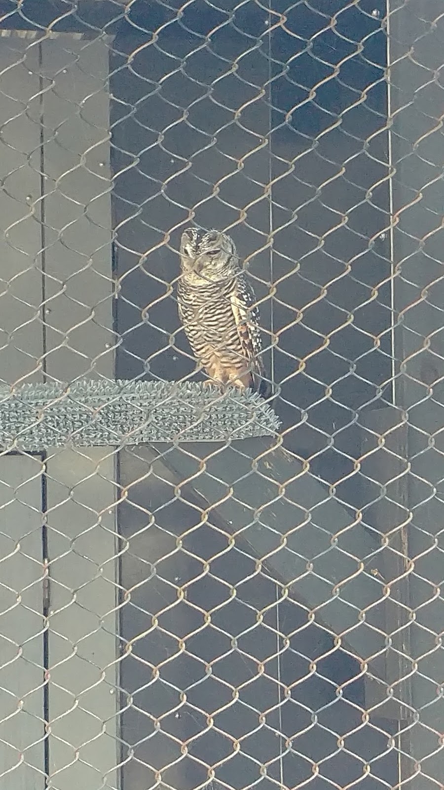
The Owl Woods housed many other owls including this thoughtful-looking one --


-- this Eagle Owl --


-- and this assertive fellow, who screeched at us the whole time we were looking at him:


There were smaller owls, too:


But the star of the show was this fellow, who demonstrated his flying abilities to us --


-- by flying right over our heads!


But he always returned to his trainer, who rewarded him well:


We must say, however, that, of all the wildlife we saw in the Low Country, the wildest of all was this all-too-common species that we found racing across the environment wherever we went:


We hadn't really anticipated the biodiversity of the South Carolina Low Country.  Combined with the availability of so many types of outdoor activities - paddling, hiking, bicycling, fishing, and more -- it will probably call us back to it the next time we travel along the Southeastern Coast of the United States.