Search This Blog

Tuesday, March 22, 2022

Walking the Lumber River to the Back Swamp

"Let's walk out the Nature Trail to the Lumber River," Kathy said.  

Call it a sixth sense -- we donned our crawfish boots (purchased in Abbeville Louisiana in March 2020 for a crawfish adventure):


Here we are at the start of the Nature Trail.  The Lumber River is in the background:


It looked very pretty and we grew excited for our anticipated adventure:


We came across some puddles, but of course we had our crawfish boots.  David demonstrated the correct "Singing in the Rain" technique:


Wait.  It got wetter.  David said, "This is no nature trail."  Kathy responded, "Water is nature, too!"


We finally splashed through to a spot where our branch of the Lumber River met another branch, forming a huge westland called, "Back Swamp."  Some nature-lover thought it would be a good idea (or a good joke) to put a picnic table out in the middle of the water.  David demonstrated the right way to enjoy the moment:


And this was the view from the picnic bench:

A big rainstorm is due to hit us here in Lumberton, North Carolina tomorrow and Thursday.  We can't imagine what the walk will look like after the storm passes through.  But -- Hey! -- it might be a good opportunity for us to rehearse that "Singing in the Rain" scene again.

See you then.

Monday, March 21, 2022

Paddling the Santee National Wildlife Refuge

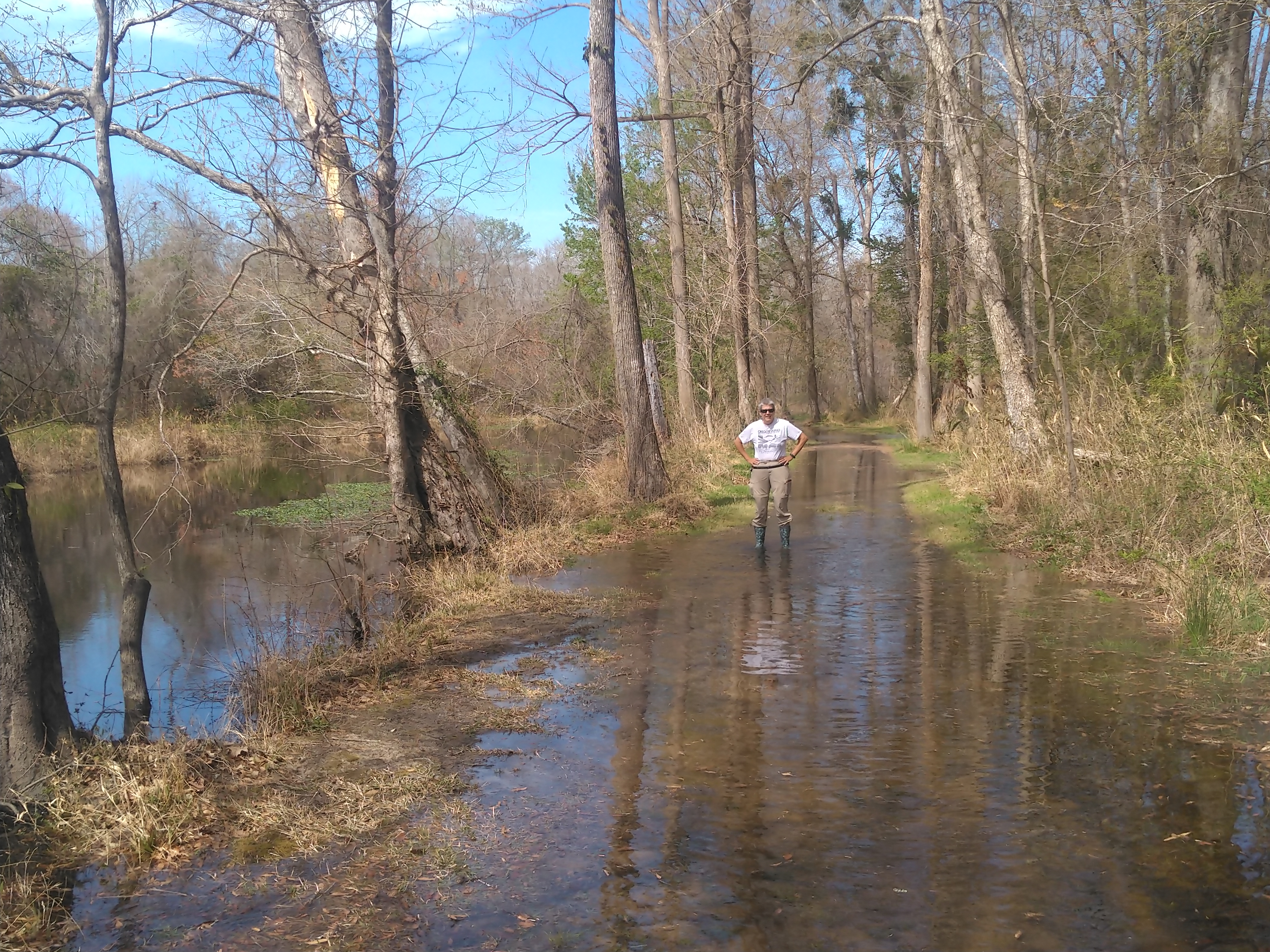
Our stop near Santee, South Carolina was supposed to be a stop of convenience, speeding us on our way North toward D.C. where we plan to help find adventures with our grandson on his Spring Break.  However, we had a free day, and the weather was beautiful (mid-70'sF, no wind, sunny).  It turned out that the Santee National Wildlife Refuge was only a few miles away, and our research suggested that we could find an interesting paddle there.

So today we drove over to the Visitor Center to get more information on a paddle we wanted to do from the Cuddo East Unit, around the Plantation Islands Wilderness Area.  Surprise:  when we got there, the Visitor Center was closed indefinitely.  We were walking back to our Jeep when one of the Refuge staff hailed us and asked us if we needed help.  We explained our goal, and he gave us a second piece of bad news -- Cuddo East is closed on Mondays.  This wasn't disclosed on the website, so we had to regroup.  Luckily, the staff member paddles and is familiar with the entire area.  One of his suggestions was to paddle from Pine Island in the Refuge.  We decided to accept his suggestion -- and we were not disappointed!  This paddle was very unique and offered us encounters with dozens (yes, dozens) of osprey.  More on that anon.

Santee National Wildlife Refuge is a 15,000-acre refuge alongside Lake Marion, an impoundment of the Santee River in South Carolina.  The refuge contains the Santee Native American mound, which is the farthest eastern known representation of the Mississippian culture. Later built upon this same mound was the Revolutionary British Fort Watson, which was taken by Francis (the "Swamp Fox") Marion and his Brigade in April 1781.  The refuge is especially important because its many wetlands support migratory birds. Within the refuge, which consists of mixed hardwoods, cypress and pines, marsh, old croplands, impoundments and open water, is a large diversity of wildlife, including bald eagles, and even the peregrine falcon. More common are deer, raccoons, bobcats, alligators, teal, wood ducks, Canada geese, mallards, pintails, red-tailed hawks, red-shouldered hawks, and wild turkeys.

The Refuge has several separate units.  Our paddle was in the Pine Island Unit.  The paddling launch was simple and primitive -- just a beach with a parking area.  The water seemed to lead into a dead end of reeds and cypress:


However, we kept the faith and paddled toward the reeds, hoping that a portal would open before us:


It did!  As we reached the reeds, a small channel through them appeared.  We worked our way through it, into a thick cypress swamp where the water was covered in a mat of vegetation.  We wondered whether we were on the right track, but paddled on:


After a short stretch, we turned right and found ourselves in a channel through the cypress trees:


Our little channel led us into an unnamed bay of Lake Marion, which is the largest lake in South Carolina and one of the 50 larges lakes in the U.S. Referred to as South Carolina's inland sea. It has a 315-mile shoreline and covers 173.7 square miles.  It was created by the damming of the Santee River in the 1940s to supply hydroelectric power as part of the rural electrification efforts initiated under President Franklin D. Roosevelt's New Deal during the Great Depression.

It wasn't long before we spotted an alligator, as well as several anhinga, many of which, such as this fellow, were perched in trees -- possibly to dry their wings, or search for fishy food, or both:


Most of the wildlife in the refuge is not habituated to human contact and would not let us very close.  As a consequence, we had trouble getting clear close-ups of the critters we spotted.  This blue heron took umbrage to our approach and set out to look for another perch:


We saw a pair Canada Geese, which we did not expect here.  They swam away from us, but eventually decided to fly on to a safer spot:


Our paddling took us from one bay to another along the north shore of Lake Marion.  It appeared to us that the northern shoreline is battered by storm winds coming from the south, because we saw many recently overblown trees -- all falling toward the north -- and much natural and other debris along the northern lakeshore, including this channel marker buoy whose floating days seem to be over:


This was one of the first locations where we paddled through huge numbers of cypress trees that were growing out of the middle of the water and seemingly happy with their situation:


Here, Kathy paddles through the cypress woods, which, to our happy surprise, broke up the waves caused on Lake Marion by the southerly winds and made our paddle much more enjoyable:


We found too many osprey nests -- each with a nesting pair of osprey -- than we can count.  Almost all of the nests were in stunted cypress trees surrounded by water, presumably a situation that promoted the safety of the osprey eggs and young from various predators.  The raptors never let us approach too closely.  In general, as we approached within 50 yards or so, the pair of osprey would abandon the nest, fly to nearby cypress trees, and cry -- presumably, we think, to attract us away from the nest.  We believe most of the nests had unhatched eggs and we think the parents were trying to protect the eggs by distracting us.

We also had the pleasure of watching the osprey fish near us.  In one case, an osprey was lucky enough to catch a big fish, but unlucky enough that the fish was too heavy to carry.  The bird had to drop the fish because it couldn't lift the fish more than a foot or so out of the water.

Most of the osprey, however, were much more successful, and they all seemed to take their catches back to the nest, pursued in flight in each case by two or three grackles who, presumably, felt the osprey owed them a free lunch.

Here, an osprey lands in the nest with a fish:


As soon as the successful fisherman/woman returned with the fish, the mate zoomed over to help consume the newly caught lunch:


In many cases, one osprey was out fishing while the mate was in the nest.  It was this behavior that led us to believe, along with their distracting strategies, that many of the pairs had buns in the oven:


We spotted some pretty moorhens hunting for food in quiet corners of the coves of the bay --


-- and this one, when we got too close, decided to fly off to a quieter area:


Spring is starting to show in this area already.  This cypress was one of the few yet with fresh leaves:


One interesting feature of the waterbound cypress we saw is that the cypress "knees" take on a different look when growing out of the water.  We thought that these knees might better be given different nicknames, but this is a kid-friendly blog, so we won't be more explicit:


Getting over her shock at seeing perverted cypress knees, Kathy headed for open water.  As we paddled back to our point of entry, along Pine Island, the sun obliged us with its glow and the wind died to nothing so that the water surface was glass.  We enjoyed the last part of our paddle through utter silence and the stillness of the water and light:


Sheila and the Case of the Traveling Cereal

 Hi Blog!

Several weeks ago, we were camped in Apopka, Florida next to a full-time RVer named Sheila. She had been on the road about a year with her two dogs. The full-time lifestyle was just not what she expected. As we know, it is a lot of work. Sheila decided to give up RVing and move back to Michigan. She sold her class C motorhome and the new owner was coming to the RV park to pick it up. Sheila was frantically trying to stuff all of her personal possessions into her car along with her two dogs. She was giving away everything she no longer needed or which wouldn't fit into her car. 

Before starting her full-time adventure, Sheila was worried she wouldn't find her favorite healthy natural cereal, so she ordered an entire case. Not wanting to run out, she ordered a second case. Unfortunately, there was no room in the car for an entire case of cereal. Sheila asked if we would take the unopened case of cereal and put it to good use. We decided to share the cereal with family and friends along our travels. 

After leaving Apopka, we met up with our friends, Karen and Connie at the Bok Tower Gardens in Lakes Wales. The first box of cereal found it's new home! We first met Karen and Connie at an Escapees Rally in April 2012. Along with Ginny and Eric, they are our oldest (i.e., longest known, not most aged) RV friends. We've met up with them in California and New York and now in Florida. They are giving up the road and plan to snowbird, dividing their time, six months in Florida and six months in New York. 


The next box of cereal went to Kathy's cousin Bobby and his wife, Judy in Sebring. Bobby was a truck driver, stock truck drag racer, and an avid RVer. Originally from Kentucky, he settled in Ohio where he met his wife Judy. Bobby use to drag race an old Ford Truck, which is now in a local car museum. He still has his RV, but uses it mostly to travel between their home in Ohio and their park model in Sebring.


We left two boxes in Stuart. George and Nan were excited to receive their box. We first met George and Nan at the Albuquerque Balloon Fiesta in October 2015, where we camped with other Escapees and crewed for balloon pilots. Since then, our paths crossed several times while we traveled to and from Alaska. They are not currently RVing and snowbird between Stuart and their lake house in Connecticut.


Our other Stuart-based RV friends, Jim and Nanc, promised to take their box on their next road trip. Who knows how far this box will go? We first met Jim and Nanc at Betty's RV Park (which, coincidentally, we found due to the suggestion of George and Nan). While Stuart is their home, they continue to travel as they visit their family and friends in Washington, PA.


Another box found its way into Dan and Gail's RV while they were camped on Jekyll Island in Georgia! We first met Dan and Gail on January 11, 2014, while hiking the Superstition Mountains from Lost Dutchman State Park. We ran into them again on March 5, 2015, in Hillsborough River State Park, north of Clearwater, Florida. Originally from Ohio, Dan and Gail are full-time RVers like us who travel every week or two weeks, working their way around the country. They also like to hike and bike and do other outdoor stuff, too. They invited us out to their campground for a barbeque.

We still have a couple boxes left, so if you plan to be on the east coast this spring, let us know.  And if you don't let us know, we'll track you down anyway!

P.S. Sheila left before we could get her contact information, so she may never know just how far her cereal has traveled.


Wednesday, March 16, 2022

Everglades - Snake Bight Trail

Tuesday, March 15, 2020

Hi Blog!

No, we were not hiking with snakes.  The term Snake Bight itself is something of a play on words; a “bight” is a bay within a bay. Before modern settlers ventured down this way the Calusa Indians lived in and around Snake Bight. Later the residents of Flamingo and visiting fishermen and hunters set up camps in the area. After several kayak adventures, we were looking for a good stretch of our legs. The four mile Snake Bight Trail was just the ticket.  It led out to a view of Snake Bight.

Here we are at the trailhead armed with our best mosquito spray:

In the early 1900’s, a canal was dug out from the bight up to the main road, with the soil used to create a road leading down to the bight, as well. While the canal is still filled with water, it suffers so many fallen trees and snags that it would be difficult to paddle.

Around 1940 the E. T. Knight Fish Company established a base at Snake Bight along the coastal edge of the canal. It had a fish processing plant and many huts and buildings for the men who lived and worked there. The fishing was done mostly with airboats as the flats were very shallow. Hurricanes and heavy storms have taken their toll on Snake Bight over the years, reducing the former road to a narrow overgrown trail and washing away almost all evidence to suggest anything other than mosquitoes ever lived there.

While long straight hikes are not our most favorite, this trail did provide lots of distractions along the way. At one point, a raccoon scurried across our path. He or she was too quick for the camera. However, this lovely purple plant was more than happy to pose for us.

We learned a lot about epiphytes. The term epiphyte is translated from the Greek (epi = on top of; phyte = plant) or 'air plants' are plants that grow on top of other plants (typically trees), co-existing in the most harmonious, harmless way. They derive their nutrients and other vitals from the air, water, dust, and debris around them. Epiphytes are not parasitic. They usually do not cause any damage to their substrate. The canopy over the trail is filled with these lovely gardens.


Here is a closer look:


We were surprised to learn that cacti do very well in the Everglades. Though often associated with deserts, cacti and succulents are common and quite diverse in the Everglades. Species that are native to the Everglades thrive with abundant rainfall, though they do require a sunny, well-drained site because they can handle wet conditions for only short periods of time. Cacti and succulents are tolerant of sandy, alkaline soils and are well adapted to the rocky locations that are common throughout the Everglades. The road bed provided the perfect nursery for this little cactus.


We came across these spiny seed pods. They looked too dangerous to touch. Turns out, the plant is the nickernut. Inside the spiny shells are smooth, shiny seeds. The word nicker probably derives from the Dutch word "knikker", meaning marble. The nickernut seed is marble-like and is used for making jewelry. The seeds are often found on the beach and are also known as sea pearls. Too bad we were afraid to touch them. We could have come home with some sea pearls.


After almost two miles, we emerged from the woods and found the boardwalk which would lead us out to Snake Bight.


The tide was out when we arrived. The bay was just a mud flat. The tri-colored heron finds the fishing easy in the shallow water.


The plover is also using the low tide to its advantage.


Unfortunately, the flamingos and roseate spoonbills were further out in the mud flats. Our camera was just not able to zoom in far enough to capture a good image.


The bench at the end of the boardwalk gave us the opportunity to relax and take in the cool ocean breezes.


As we headed back to the trail, we could see the remnants of the old canal. The mud flats give way to the buttonwood mangrove. The buttonwood mangrove is not a true mangrove but is generally found in areas where mangroves grow. They grow further inland than all three true species of mangroves and because of this, they are excellent buffer systems for winds, pollution, and storm surge.


A number of butterflies joined us on our hike. Try as we might, they were most shy and refused to be photographed. It wasn't until this common buckeye landed on the trail ahead of us that we got the chance to score a photo.

Named for its conspicuous target-shaped eyespots, the common buckeye is one of the most distinctive and readily-identifiable North American butterflies. It inhabits a wide variety of open, sunny landscapes including old fields, roadsides, utility corridors, gardens, parks, yards, fallow agricultural land, scrubs, pine savannas, and weedlots.

The common buckeye butterfly regularly expands its range northward each year to temporarily colonize much of the U.S., occasionally reaching southern Canada. Starting in late summer, huge numbers of adults migrate southward into Florida, where the adults overwinter. Just like a lot of RVers we know.

We were curious about these bright red air plants. We learned they are Vernicosa Tillandsia  The name “vernicosa” means “polished” which refers to its floral bracts. The Tillandsia vernicosa is a medium sized plant that can grow up to 10-12 inches in diameter. In the wild you might see stunning clumps of vernicosa growing up in trees. The examples we saw were impressive.

Our grandson would be disappointed if we didn't include at least one "fun guy" in our blog. Here is a little white and orange combo. Two for the price of one doesn't get much more fun.

We leave you with a lizard on a log.


 On Wednesday, we begin to head north. We enjoyed our week paddling about the Everglades.

Tuesday, March 15, 2022

Everglades - Paddling to the Wilderness from Nine Mile Pond

Monday, March 14, 2022 was our last opportunity to paddle in Everglades National Park.  We've really enjoyed what we've done so far, and we were eager to get out onto the 6+ mile paddling trail beginning at Nine Mile Pond.

As the whole week has been, the day was very windy when we started paddling, but on the upside, we had no bugs.  Unfortunately, the entire first part of our paddle, some 2.5 miles, would be straight into the wind.  We were uncertain how successful this trip would be.


Our paddle began on Nine Mile Pond and ended on two smaller, adjoining ponds.  The trail description told us that these ponds would be our best opportunity to see wildlife.  We weren't disappointed, given the heaviness of the winds today.  We saw a flock of white ibis roosting in the wind as we paddled up the shoreline.  They fled as we approached:


We also followed four anhinga, who first moved away from us by swimming in the water, but then decided we were too dangerous and took wing:


At the opposite end of the pond, we entered the portal to the trail, which was marked by a white pole with a number "1" -- the first of 116 markers along our trail.  We enetered the portal and felt like Alice as she fell down the rabbit hole:


Just like a Cheshire Cat, this night heron spotted us and hopped off into the tangled roots of nearby mangroves, but could not escape our intrepid camera:


Leaving the mangroves momentarily, we popped out into a wide, open range of shallow water graced by green spike rush:


At several places along the trail, we had the opportunity to view the fabled Paurotis Palm, which is rare and only grows on relatively high ground in the Everglades:


The entire first half of the paddle trail, to Marker #72, was like a maze.  Here, Kathy claims victory in spotting Marker #31:


At Marker #44, about 1.5 miles into the paddle, we stopped for lunch:


Air plants graced the branches all around us:


When we had finished lunch, we paused to examine the very unique, spongy, beige colored biotic mass of algae, known as periphyton, that floats in little clouds across most of the water in the open, freshwater marl prairie:


In the photo below, you can see the spongy biotic mass floating on either side of the channel, while spike rush graced the channel itself:


The entire area boasted only two flowers that we could identify -- the small yellow flowers of the bladderwort, and these larger, white blossoms graced with red and green highlights, standing proud but vulnerable above the water:


Approaching the far point of our paddle, we re-entered the mangrove forest and the very narrow channels that challenged us to break down our paddles and maneuver carefully along the sinuous, dark channels:


Sections of the wildgrass prairie hosted small islands of mangrove, some comprised of only one plant:


After about 2.5 hours of paddling, we reached Marker #72, the far point of the trail, where only wilderness could be seen to the west.  We rested, drank some water, and looked forward to our chance to paddle back toward the beginning of the trail with the strong wind behind us:


In the middle of the wild, marl prairie, we came across what we dubbed, "The Littlest Walking Tree," because this baby mangrove was so brave as to try to grow where none others had tried yet:


Halfway back in our paddle, the clouds separated, the sun came out, and the prairie became a beautiful palette of colors:


Finally -- Marker #100 of 116!  We had finished a channel that remains from an old airboat route, and we were about to work our way across the prairie to two smaller ponds that would mark the end of our paddle:


We found a spot where the two most common shrub species -- mangrove, with its oblong leaves (on the right), and cocoplum, with its rounded leaves (on the left) -- were accessible right on the water:


It wasn't long before Kathy led us into the first of the final two small ponds:


We worked our way through each of the two smaller ponds, back out onto Nine Mile Pond itself, where the winds made their strength known to us again.  We were blown straight across the lake to where our Jeep was parked, and blown up onto the beach.  Once we had landed, Kathy checked the final statistics on her GPs -- 6.4 miles in 4.5 hours!

We're tired but elated at such an epic paddle!  We're sorry we won't have more time here in the Everglades before we start our drive north for our grandson's Spring Break.  Safe travels!