Friday, March 17, 2023
Hi Blog!
We've made it to our next stop near Four Oaks, North Carolina. We are about an hour away from the Raleigh-Durham area. After moving on Wednesday and logistics on Thursday, we were eager to get out and stretch our legs. We set our sights on the Eno River State Park.
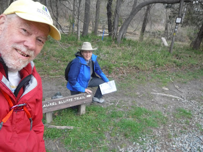
The Park contains more than 4,500 acres of protected natural area that provide vital water quality protection, wildlife habitat, and preservation of historic resources. There are five access areas with over 24 miles of trails offering entry into a largely unspoiled river environment. We started our adventure at the Pleasant Green Access and hiked beginning on the Laurel Bluffs Trail.
Partnering with the Nature Conservancy, the State of North Carolina, the City of Durham, and Durham and Orange Counties, the Eno River Association was able to create the Eno River State Park in 1973. Since then, the Association has worked tirelessly to expand the Park in order to protect the natural and cultural heritage of the Eno River and to ensure that the public will be able to enjoy it for future generations. One of the Association's projects was adding birdhouses along the trail.
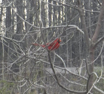
Spring is definitely in the air. The cardinals along the trail were busy courting. This guy stopped to catch his breath before heading back into the fray.
Dave doing his best impression of a cardinal:
Eno River State Park is home to the Parkwood bamboo grove. The Eno River Association hopes to manage the bamboo grove to create a productive and esthetically pleasing public space. A healthy grove of bamboo is uniquely beautiful, is a good habitat for birds, reduces rainwater runoff from surrounding land, and offers a pleasant parkland for walking and contemplation. We contemplated the grove (in the background in the photo below) from the bridge over Euclid Stream.
The trail leaves the Laurel Bluffs and comes down the banks of the Eno River. The Eno River, named for the Eno Native Americans who once lived along its banks, is the initial tributary of the Neuse River in North Carolina. Descendants of European immigrants settled along the Eno River in the latter 1740s and early 1750s, including many Quakers from Pennsylvania.
We followed the river downstream until we reached the cut-off for the Eno Quarry Trail. The Eno Quarry was excavated in the 1960s to provide stone for the construction of nearby Interstate 85. When the project was completed, a number of large blue boulders were left behind.
Over time, the quarry filled in naturally with water, and visitors soon followed. The quarry was originally on private property, and locals would trespass to swim, fish, or cliff jump. Today, it is part of the state park. While it is not illegal to swim, there are several rather large signs suggesting it is deep and dangerous. With the recent cold weather, no one was swimming today, although we met one hiker who said that he loves to swim in the quarry during the summers.
We followed a loop trail around the quarry lake.
The top of the quarry is rather boggy.
Rhodes Creek runs right along the edge of the quarry.
In order to continue our journey, we needed to cross the creek.
After circling the quarry, we headed toward the Cabe Lands Trail. The "Cabe" of Cabe Lands refers to Barnaby Cabe who owned the land from before the American Revolution. In 1760, Mr. Cabe purchased 112 acres of land along the Eno River. He managed a gristmill on four thousand acres, and had nine daughters. His two wives predeceased him.
After crossing the Cabe Lands, we decended back toward the banks of the Eno River.
At one point, there were thirty-two different mills along the Eno River. The last mill ceased operations in 1942 when a flood broke the dam across the river. Eventually, the building collapse from old age and neglect in 1973. There are still some foundations and diversion channels cut into the banks. These two fine bridges were an Eagle Scout project that helped us cross a couple diversions.
On our way back to the trailhead, we decided to take another hike around the quarry lake.
A diver recently went to the bottom of the quarry. It was 55 feet down, pitch black and 48 degrees Fahrenheit.
The Eno River is a swift, shallow stream flowing for 33 miles from Orange County to Durham County. It's waters roll through wilderness, passing historic mill sites, river bluffs covered with flowering shrubs, and fords used by early settlers. Here are some of the tiny wildflowers we spotted.
We had a mile left in our hike when the wind began to pick up and the rain they predicted for later this afternoon came early. The last photo we took was of a turtle family on a log.

The rain and cold predicted for this weekend may keep us home. Until the next adventure, stay thirsty my friends.


No comments:
Post a Comment
Note: Only a member of this blog may post a comment.