Search This Blog

Monday, May 16, 2022

Paddling Long Arm in Reelfoot National Wildlife Refuge

As we've reported before, the top one-third of Reelfoot Lake is protected by the Reelfoot National Wildlife Refuge.  It is shallower and more heavily populated by waterbound cedar forests, pond lilies, duckweed and the like.  On Sunday, May 15, 2022, we tried the third of four launch points within the Refuge.  This launch site gave us an entry to a section of the lake called Long Arm -- a small basin north of the others we have paddled.

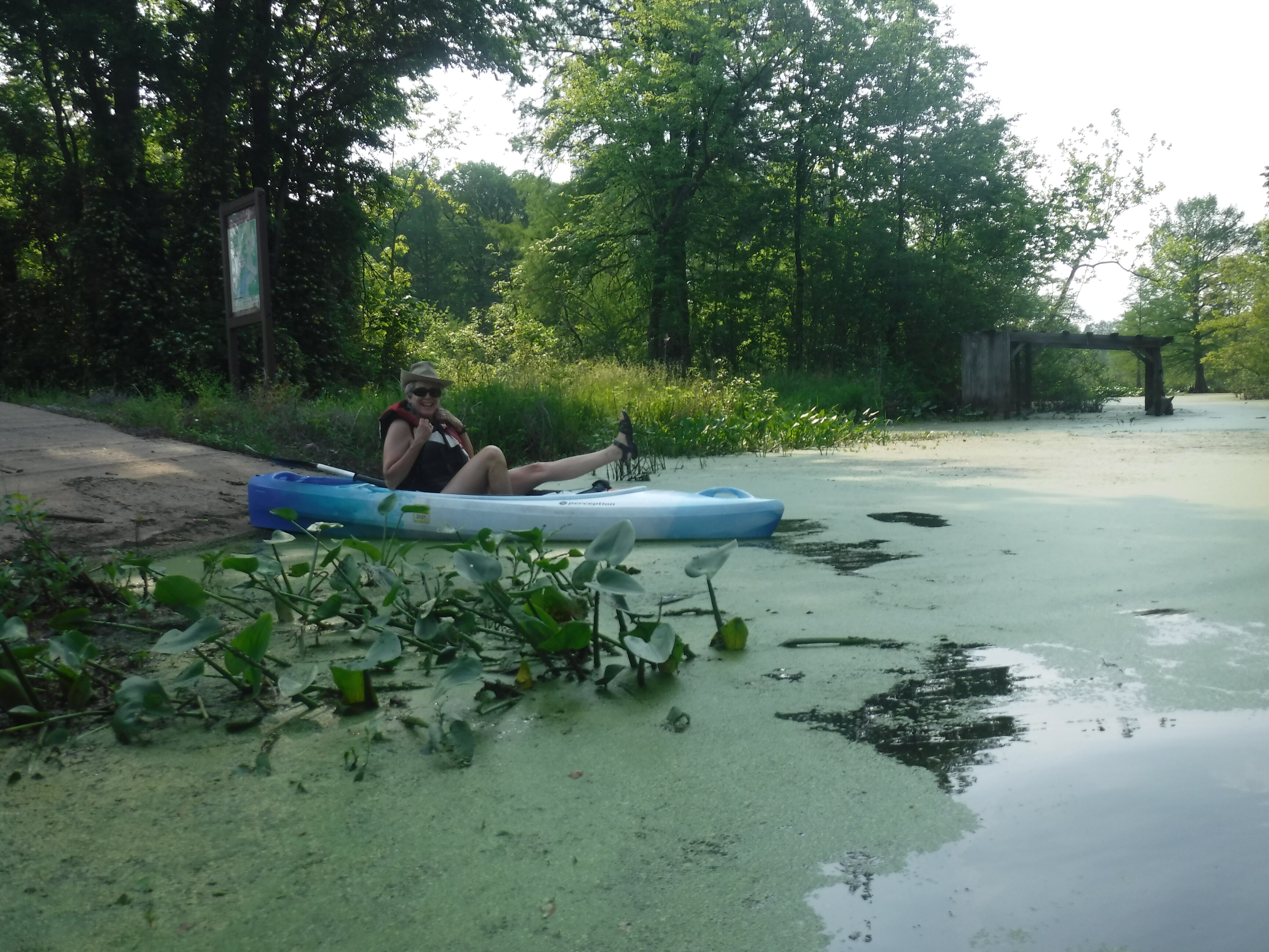
We had the parking area to ourselves and took advantage of the empty launch area to paddle slowly toward a dense cedar forest growing out of the swampy water:

The still water reflected the blue sky and dark green canopy, the shadows in the upper reaches of the trees making the water look inky black as our kayaks glided through it:

The route from our entry point to Long Arm led through the cedars and into a narrow channel through lilies and grasses:

Duckweed was abundant in the channels, requiring a shallow paddle stroke.  We moved leisurely across the water.  Kathy decided to try her hand fishing for bass, crappies or other fish endemic to Reelfoot Lake, while David hunted for photograph subjects.  As we paddled down the channel, Kathy cast to where she guessed the big ones were feeding:

Reelfoot National Wildlife Refuge has taken remarkable pains to post informational signs at regular intervals on its three paddling trails.  We were not disappointed to see one as we approached a turn south toward Long Arm.  It was very helpful; it informed us that what we know as pond lilies are also known as spatterdock.

As if to illustrate the sign's explanation that spatterdock boasts round yellow flowers, the plants directly in front of the sign bore one of the season's earliest mustard-colored blooms:

Turning south toward the top of Long Arm, we enjoyed spatterdock on both sides of us and duckweed under us -- a profusion of emerald under an aquamarine sky:

All these other greens inspired the duckweed to monopolize our attention with its swirling, fractal patterns in the water:

Meanwhile, above the surface, we found a birdbox marking our paddling trail and standing guard over the junction where we would return after following a loop into and back up Long Arm:

How can we even describe how much we love the beauty of this environment?


We worked our way east and south through a narrow channel and finally found our way into the main body of Long Arm. This is the view we had as we entered Long Arm. 

At this point, Kathy decided to try to fish the open water, while David paddled south to explore the length and southern end of Long Arm.  Here, Kathy readies her next fly to tempt those elusive fish:

Dragonflies are some of the most curious and interesting insects on lakes.  Many will land on our kayaks, thinking they are plants or other friendly landing zones.  We don't know whether they have any curiosity about us personally, but they often stop by and pause a while -- long enough for us to take their portrait if we're quick enough:

In his exploration, David spotted two beaver lodges!  The Visitor Center exhibits did reveal that beaver inhabit the Refuge, but we did not take that information literally.  We have visited many public lands where beaver allegedly homesteaded, only to find that there were no beaver at all in the places that would be their natural habitat.  So, when we read that beaver were present, we took the information with a grain of salt.  Yeah, sure.  But to our happy surprise, beaver seem to thrive in this shallow water.  No need for beaver dams because the pond is provided already by mother nature and the lake is too big for a little beaver to dam.  But it seems like a nice place to raise a family, nevertheless.


We are sad to tell you that Kathy caught no fish, and David found no treasure at the end of his paddling rainbow -- but we both received something more important than either of us consciously thought we were seeking:  a discovery of the wonders of a beautiful, wild solitude.  For example, there is a special peaceful or spiritual feeling to glide through still water, especially where it feels like we're in the wilderness, miles from the hubbub of civilization. 

 Here is a hint of what made us feel this way:


This was our last paddle at Reelfoot Lake.  Now we move east and north, through Kentucky, toward a Memorial Day weekend with family.  We hope to have another outing or two before then, but this might be our last paddle for a while.

Until the next outing, stay adventurous, my friend.

Friday, May 13, 2022

Paddling the Goose Pen

Friday, May 13, 2022

Hi Blog! 

We had a great first day at Reelfoot Lake, but boy was it hot! Before our paddle yesterday in the Reelfoot National Wildlife Refuge, we stopped at the Refuge Visitor Center.  We spoke with one of the volunteers, who was new to the area, but had all the maps and brochures we needed to plan several paddling adventures. 

Today's adventure took us to the north end of the Refuge known as the Long Point Unit. There are two canoe trails up north -- the West Boat House Canoe Trail and the Goose Pen Canoe Trail. We chose the 2.1 mile Goose Pen because today was going to be another hot one. Thunderstorms were predicted for the afternoon. Because today was Friday the 13th, we didn't want to push our luck with a longer paddle.


The entrance to the Long Point Unit is actually in Kentucky. Luckily for us, we had our passports with us (just kidding). Truth be told, there wasn't even a sign mentioning we were leaving one state and entering the other. The only difference we spotted was that the lines on the highway in Tennessee were just freshly painted. 
 
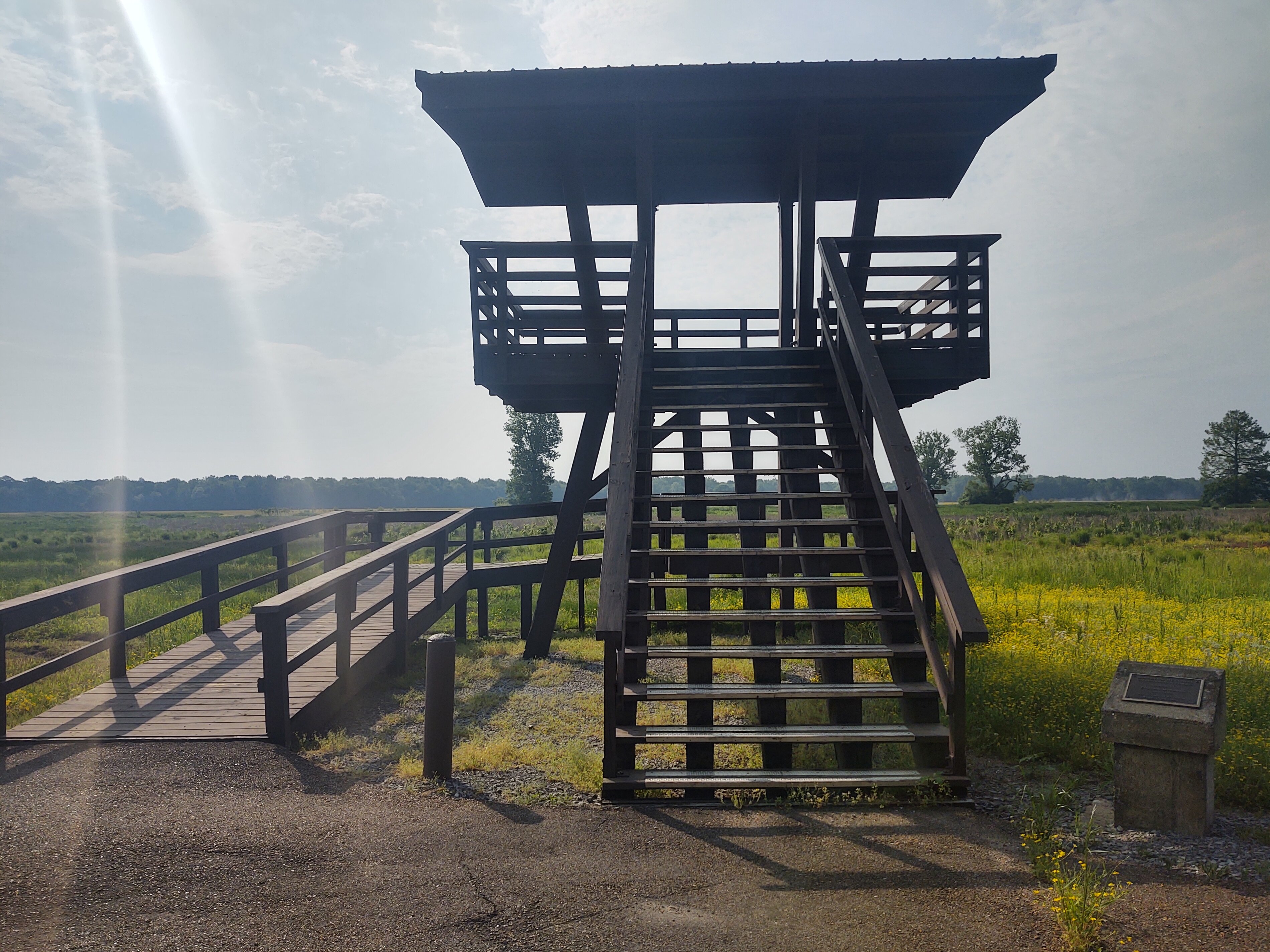
We made a quick stop at the Refuge entrance, but there wasn't much to see from the observation tower, so we proceeded to the boat ramp.


Dusty likes it when we has the trailhead to himself. Behind him are acres and acres of farmland. The land in the Refuge is managed to provide forage for the migrating birds, so some of the Refuge land is farmed.


Just across from the trailhead was an observation blind. If you look carefully, you can observe Dave checking out the view.


When we first approached the boat launch, we couldn't find the water. All we saw was a carpet of green. We were worried at first that it might be an algae bloom. Upon closer inspection, we realized it was just tiny little floating green leaves known as duckweed. Duckweed flourish by floating atop still or slow-moving fresh water. Their reproduction can be extremely rapid, doubling mass in as few as two days, forming a virtual carpet across the water.


As we began our paddle, we left a wake in the green carpet:


As it turns out, duckweed is very nutritious. Dried duckweed is almost 35% protein. It also contains a lot of amino acids and omega-3s. All that duckweed is perfect for the ducks and other waterfowl that winter over in the Refuge.
 
We found these really well made bird boxes all along the trail:


We didn't realize the paddling trail would have interpretive signs. We learned all about the northern map turtle, broad-banded water snake and bluegills.


There are a number of channels cut through the slough. Our trail was marked with red diamonds.


This part of the Refuge reminded us of paddling through the Okefenokee Swamp -- sans the alligators. We actually missed seeing gators.


Just after we read about the broad-banded water snake, one happened to swim across our path. Kudos to the Refuge ranger for a well-placed sign.


All through our paddle, we kept disturbing a great blue heron. Try as we might, we couldn't get close enough to him for a photo. Here is the heron flying away from us yet again.


We followed the First Arm south through the Refuge and came out at the very top of the Upper Blue Basin. The first thing we encountered was this hunting blind owned by The Cooper Hole, LLC, a duck and goose guide service. The blind sits 50 yards from the boundary of the Wildlife Refuge. The blind is equipped with the latest amenities, including a television and restroom!


However, like many of the blinds we passed yesterday, it shows some damage, especially after the December 10, 2021 tornado came through.


When we planned our RV trip from Virginia to Crater of Diamonds in Arkansas, we never realized how close our route would follow the path of the deadly tornado that began in northeastern Arkansas and then tore through Tennessee and Kentucky. Now that we are here, we are happy to contribute to the economy of the region as they continue to rebuild.
 
Some Refuge residents seem to have been unfazed by the tornado:


Once we reached the open water of the Upper Blue Basin, we sat back and took it all in.


The winds were a little stronger than yesterday. Small waves washed across the lily pads and rolled around the surfaces of the pads. The sunlight reflected in these tiny pools cast rainbows across the surface of the water.


With the day heating up, we turned our kayaks back to the trailhead. We followed the First Arm Ditch back into the Refuge. Click the following link to watch this 360-degree video showing the open channel


Because the channel is so shallow, we had to turn our paddles backwards to avoid gathering plant life. The shallow channel also meant that fishing boats rarely come into this area. The entire time we paddled, fish were jumping back and forth across our path, and there were no fishing boats nearby.


Our paddle was just over two miles and took about two and a half hours. We were off the water by 11:30. The thunderstorms came as promised around 3:00 p.m. It may be a couple days before we get back out, but we are hoping for one more trip on the lake. Stay tuned.


Thursday, May 12, 2022

Paddling in Reelfoot NWR - Grassy Island Unit

Reelfoot National Wildlife Refuge, established in 1941, comprises land surrounding about one-third of Reelfoot Lake, located within four miles of the Mississippi River in rural northwest Tennessee, to provide habitat for migratory birds, including dabbling ducks, diving ducks, and geese, as well as local waterfowl such as great blue heron, egrets, and moorhen.  The refuge is also home to nesting eagles, osprey and hawks, as well as numerous fish species.  The lake was naturally formed as a result of the 1811-1812 New Madrid earthquakes -- considered the most significant to hit the continental United States in recorded history.  These earthquakes reportedly caused the Mississippi River to flow backwards when an area just south of the Reelfoot refuge, known as the Tiptonville Dome, was thrust violently upward into the path of the river.  Likewise, an area as much as 30 miles long and 10 miles wide, by some accounts, sank up to 50 feet, creating a sunken forest and forming the present-day Reelfoot Lake.

We wondered what the origin was of the name, "Reelfoot," and discovered that it was the result of a mistake.  Early maps of Tennessee from the late 1700's show the area around modern-day Reelfoot Lake as the "Redfoot River." Current thinking is that, due to sloppy reading or penmanship, mapmakers copying those maps erroneously mistook the “d” for “el.”

If you are interested in cultural history, folk hero Davy Crockett spent time hunting and trapping in the Reelfoot Lake area during the early 1830's.  Several local landmarks are named after him.  In recent years, Reelfoot Lake was a filming location for three movie productions: "Raintree County" (1957), "In the Heat of the Night" (1967), and "U.S. Marshals" (1998).

Be that as it may, Reelfoot Lake is a spectacularly unique environment -- a shallow lake encompassing an ancient cypress swamp, so that cypress trees flow across the lake and its basins as casually as birds might swim its waters. 

We started our paddling visit by venturing out to an observation deck on the shore of the lake to see what it was like:

 
The cypress trees dominated the area, providing an exotic, semi-tropical ambience.


We were excited by what we saw and rushed to the launch site to put our kayaks in the water:

 
The spot where we launched was at the junction of two dredged canals or ditches.  A number of these canals connect Reelfoot Lake and the basins which comprise the northern third of the lake that is within the Refuge -- Blue Basin and Buck Basin.   We started across one of the canals toward Blue Basin, and quickly ran into this pretty wisteria vine growing among the cypress and pines.  Kathy had to hug it:
 

Reaching Blue Basin, we looked across, and this cypress tree caught our eye --

-- before we spotted a sizeable number of duck blinds sitting around the lake reminding us of the homes we saw on Inle Lake when we visited our son Matt, his wife Weina and our grandson William in 2018:

The Tennessee Wildlife Resources Agency conducts annual drawings for duck hunters to take chances on the right to use one of the Reelfoot Lake duck blinds during duck hunting season.  The blinds are all very primitive and are maintained by the State of Tennessee.  Their use is strictly regulated, but, even so, a "grey market" has arisen in the buying and selling of the resulting duck blind usage rights, disagreements can arise among duck hunters who compete to use the duck blinds.  In 2021, three hunters lost their lives over an ongoing squabble between occupants of two public blinds.

Luckily, we didn't know anything about this grisly side of Reelfoot Lake as we paddled through the gorgeous stands of cypress in the lake:

Some of the trees have grown into their own versions of bonsai:

We just couldn't get enough of them, and spent more than an hour paddling around:

In the process, we examined several of the blinds.  This one has become more modern abstract assemblage art than practical duck blind:

In the process of poking about Blue Basin, we began to realize that abundant wildlife was all around us, but was just shy and difficult to spot.  Once we realize that the lake was full of osprey, we were seeing them everywhere, including this one who flew away when we tried to photograph him:

His mate, however, was stuck on the nest, presumably because they were incubating an egg or two.  As we approached, she cried to her mate with some anxiety about our approach.  We decided to leave off before getting too close, because we really didn't want to disturb her too much:

Anhinga showed up on the lake too, even though the Refuge documentation doesn't advertise them.  Here was a family of two parents and their two youngsters, sunning and drying their wings as they perched on a log --

-- only to flee in a skittering line as we approached:

By this time, it was noon and we were getting hungry (not to mention getting fully roasted from the 90F-plus heat in full sun on the open lake), so we turned our kayaks back down the canal toward our launch spot.  Today we would have a launch lunch.

As we returned along the canal, we spotted this great blue heron and egret poking their heads up out of the waterlilies to check our passage with suspicion while looking for their own lunch:

After lunch, we spent our afternoon paddling lazily down one of the canals, because it was shady and would help cut the heat of the sun.  Paddling the canal gave us a chance to understand how the canals, lake, swamp and islands, including the built-up roads through the present-day Refuge, relate to each other.  The Refuge road is protected from water erosion by a series of large culverts that allow the swamp and canal water to flow under the road rather than undercutting it:

The Refuge's primary purpose is the protection of waterfowl, including migratory birds.  This does include protecting and providing sources of food, but, in general, does not involve creating artificial structures for nesting. Nevertheless, someone had erected a bird box along the canal.  Clearly, from the decrepit roof, it has seen better days, and it did not look like there were any inhabitants:

Our entire paddle was about 6.5 miles.  Of this, the canal was about 1.5 miles long, making for a 3 mile paddle out-and-back after lunch.  At the end of the canal, we found that it linked back to the lower end of Blue Basin.  We worked our way through the cypress trees and out to the basin:

As we emerged into the open basin, we happened upon another duck blind.  This one had been more elaborate than others we saw, but in its elaborateness it was also more vulnerable to the elements and has almost decayed to nothing.  Interestingly, the sign posted on it read:

This is an unregistered duck blind. No hunting is allowed at any time.  RNWR [Reelfoot National Wildlife Refuge].

This was our first hint that fishing and duck hunting on Reelfoot Lake provokes great passion among the locals, which is borne out by the discussion we've given you above about the allocation of duck blind rights.  But, just in case you think that is a mild aberration, you need to understand that Reelfoot Lake only became a publicly managed fishery and hunting area because locals had protested its exclusive ownership by a logging company -- to the point that they formed "Night Rider" vigilante groups to wreak vengeance on the private owner -- even including kidnappings and murder -- to try to pressure the company to allow public hunting and fishing.

Such a peaceful place with such a troubled human history.

We hope to get one or two more paddles in this gorgeous Wildlife Refuge before we leave this area next week!