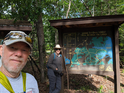
We're on our way home! After enjoying the Great American Eclipse in Uvalde, Texas, and joining our friends Kim and Jane in San Antonio, we took another step north to Sam Rayburn Lake in Brookeland, Texas. We had one day - Saturday, April 13, 2024 - to explore and decided to hike the Trail Between the Lakes:
About a mile into the hike, we crossed a railroad track as we followed a forest road from one section of foot trail to another:
Our route along the forest road was perhaps half a mile. It led us downhill from the upland section where we started, into a lower area laced by drainages. We began to realize that this would be a hike of leaps across small streams and drainages as much as it was a hike across dry terrain.
As we worked our way down the road section, we saw that the forest crew was busy clearing drainages along the road, renewing culverts, and installing concrete portals for the streams crossing under the road:
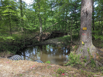
At this stream crossing, the culverts looked newly installed, but -- still -- the stream seemed to be almost too much for them:
It is early spring, and we spotted a few wildflowers along the path:
The leaves are out, and, in some places, they create a bower-like effect, which offered shade that we both enjoyed:
Recent storms that had marched across the U.S. left wet sections on the trail. They were easy to navigate, but they added needed moisture to the forest floor and gave us an unusual view of the woods:
In addition to mushrooms and other more common fungi, we spotted these unusual little red ball-like fungus growths on the trunk of one of the pine trees:
This hole with sculpted mud around it offered us a mystery. Who was the resident? It turned out that the ground was so damp that CRAWFISH have found the opportunity to make little tiny houses. Who would have thought?
It was indeed damp enough that moss was growing on the shady side of trees and stumps, and we were lucky enough to see some rich samples:
Indeed, this area, being laced with streams and drainages, offered us TEN stream crossings! They were each small enough to leap with an easy hop, so we were not hampered. But this may have been the most stream crossings we've had in a single day hike: Twenty!
As we were finishing our hike, Kathy spotted this tree. It is marked as a "bearing tree," in addition to having a blaze and other markings on it. As a bearing tree, it is used in the survey description for boundaries of various tracts in the Sabine National Forest. Based on this and the work along the forest road, we concluded that this forest is very well managed.
We only had one day in northwest Texas before heading on to Crater of Diamonds State Park in Arkansas, but we made the most of it. The next time you hear from us, we will have something to say about diamonds!


No comments:
Post a Comment
Note: Only a member of this blog may post a comment.