Search This Blog

Wednesday, March 30, 2016

Monumental Mount St. Helens

Hi Blog!

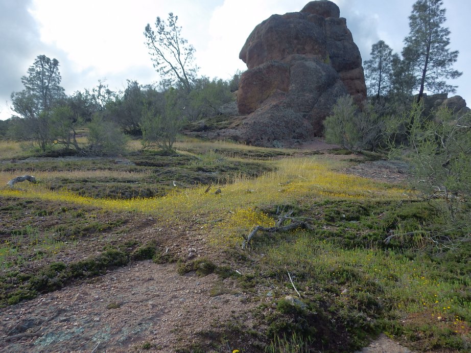
It has been almost two weeks since our last blog. We've spent most of that time moving north and visiting with family in both Oregon and Toronto. We are currently camped in Kelso, Washington, which is about an hour north of Portland, Oregon. This gives us access to both family and a number of scenic wonders. High on our bucket list was a visit to Mount St. Helens National Volcanic Monument. On Tuesday, March 29, 2016, we decided to drive over to the Silver Lake Visitors Center and gather information on hiking around the monument. Here is our first look at Mount St. Helens.


We started our tour of the Visitors Center with a 20 minute documentary on the 1980 eruption. The catastrophic eruption occurred on May 18, 1980, at 8:32 a.m. It was the deadliest and most economically destructive volcanic event in the history of the United States. Fifty-seven people were killed; 250 homes, 47 bridges, 15 miles of railways, and 185 miles of highway were destroyed. A massive debris avalanche triggered by an earthquake measuring 5.1 on the Richter scale caused an eruption that reduced the elevation of the mountain's summit from 9,677 ft to 8,363 ft, replacing it with a 1 mile wide horseshoe-shaped crater. Here a series of photos capture the moment of eruption.


After the movie, we walked around the various exhibits. They even had a model of Mount St. Helens that you could walk into and explore the various layers. The magma chamber inside the model glows bright red.


Outside the Visitors Center is a one mile nature trail that leads out into the marshy area of Silver Lake. Here, a local resident soaks up some spring sunshine.


Mr. Duck wasn't the only one enjoying a sunny day on the lake.


To get to the base of the volcano, we had a long drive up Spirit Lake Highway. There were a number of scenic overlooks. While the Forest Learning Center was closed, the parking lot and viewing platforms were open. Here we are looking down on the Toutle River Valley. After the eruption, grass and clover were planted along the river in hopes of stopping ash and silt from flowing downstream. As the grass took hold, elk moved into the valley. Try as we might, we weren't able to spot any.


We tried again at the Elk Rock viewpoint. While still no elk sightings, we did get some amazing views of Mount St. Helens.


Our next stop took us up to 3800 feet. A snowy blanket covered the ground. We got our first look at Castle Lake, which was created by an avalanche which dammed the mouth of Castle Creek.


We were unable to reach the Johnston Ridge Observatory at 4,200 feet as the road is closed in the winter. We consoled ourselves with a visit to Coldwater Lake. When the landslide from Mount St. Helens slid into the North Fork Toutle River Valley, it blocked the flow of Coldwater Creek. Water backed up behind the landslide deposit, gradually forming this lake.


Concern about the sudden breakout of water from Coldwater Lake from failure of the debris dam or overtopping and subsequent erosion of the dam, led the Army Corps of Engineers in 1981 to control the lake level by excavating an outlet channel that delivers water down to the Toutle River. Here is the new and improved Coldwater Creek.


We had a great first day in the Mount St. Helens National Volcanic Monument.   She agreed to let us take this selfie with her:


We are looking forward to coming back and hiking in the area, and we think we have some great, scenic ideas for hikes.  Stay tuned!

Friday, March 18, 2016

Eddie & George Wake Up on the Coweeman River

... in Kelso Washington, near the river's confluence with the Cowlitz River and then the Columbia River!


Spring is just arriving.  The weeping willows have awakened, but the birches are still sleeping:


Human activity in the morning is pretty scarce, because it was only 37F this morning as we started our walk to breakfast:


Strange Forces in the Oregon Vortex

We had little time to play tourist in the Medford area because we need to get up to the Portland area to make a flight to Toronto to keep Little William company while his parents have to work during the second week of his preschool spring break.  Before spending a wonderful dinner and evening with Tom's sister Mary Beth and her husband Scott, we had just enough time to explore the Oregon Vortex:


The Oregon Vortex is a roadside attraction located in Gold Hill, Oregon, only a few miles from the RV park where we were staying. It consists of a number of interesting effects.

The site is coincidentally located only 200 yards from where gold was originallty discovered on Sardine Creek in Gold Hill, as this sign attested:


According to the tour guide, the history of the Oregon Vortex goes back to the time when Native Americans populated the area. Their horses would not come into the circular ground comprising the Oregon Vortex. The Native Americans called the area the "Forbidden Ground", a place to be shunned. Before any buildings were constructed on the ground, settlers noted that unusual conditions existed there.

John Litster was a geologist, mining engineer, and physicist. He developed the area in the early 1920's and opened it to the public in 1930. He conducted thousands of experiments within the Vortex until his death in 1959.

The central physical feature of the Oregon Vortex is a building that was originally an assay office built by the Old Grey Eagle Mining Company in 1904.  The strange slopes of the building give rise to optical illusions, both inside and out, as explained by our tour guide below:


The dizziness that people sometimes experience in the house is based on the disorienting way people have to stand when they go through it.  David experienced this as we stood beside the house, but the tour guide explained that the dizziness is a result of the optical confusion, not any mysterious forces.

He demonstrated how the angle of the sinking floor of the old assay office building make it seem that a person standing inside is tilted off vertical:


He demonstrated how irregular the slopes of the floor, walls and ceiling are by balancing a broom to demonstrate true vertical:


Investigators from the SyFy reality show, "Fact or Fake: The Paranormal Files," checked out the Oregon Vortex.  The "Fact or Faked" team, led by former FBI criminal investigator Ben Hansen, used scientific equipment to measure the odd angles and warped floor of the Vortex's famous Mystery House. They determined that certain brooms could easily stand on their own based on the type of bristles and the angle of the floor. They also debunked the appearance of a ball rolling uphill as an optical illusion -- it's actually rolling downhill, but the house's slanted walls play tricks on the eye. The tour guide cheerfully volunteered to us that all of the effects inside the building are optical illusions, so it certainly didn't seem that the owners of the attraction were dissembling with us.

One effect that cannot be explained as an optical illusion is one that the tour guide asserts can be experienced anywhere within the circular area on the vortex ground.  The two photos below illustrate it.  The two photos are identical except for the position of each of the individuals.  As the individuals change position, their relative sizes change to a greater degree than can be explained by perspective. The tour guide proved with levels and measurements that the effect is not merely optical.  Kathy (second from left) participated, but still couldn't figure out the mystery:


The height change anomaly also proved difficult to explain. The "Fact or Fake" team determined that the spot where people stand on a level surface and appear to shrink or grow when they change positions actually has a two-degree incline. But that's not enough to explain the 16-degree difference they captured on camera.  Thus, this anomaly is not explained.  Our tour guide told us that the original owner, John Litster, theorized that the forces at play in the Oregon Vortex have an impact on the mass density of people and objects that are within its bounds.  So the theory goes, people who are closer to the center of the vortex experience "compression" of their mass density, which results in their actually becoming shorter.  In the photo above, the center of the vortex would be to the left, thus explaining how people appear to get smaller as they move to the left in the photo.

Other investigations by the "Fact or Fake" team were also inconclusive. Animals, it's said, are repelled by the magnetic or gravitational forces at play in the Vortex, so the investigators tried riding horses through the site. Before getting to the Vortex, the horses completely stopped and reversed direction. The TV show's investigative team also got strange compass readings during their experiments, suggesting that massive magnets might be buried under ground, though they weren't allowed to do any excavation to determine if that was the case.

We came away from this tour wondering, indeed, if unusual gravitational forces are at play in the Oregon Vortex.  We'll leave it to future visitors such as you to try to find the answer.

Bicycling to the Oroville Chinese Temple

Blog Entry: Monday, March 14, 2016.

After four straight days of rain (snow in the higher elevations), we were suffering from a severe case of cabin fever. We needed to get out and about, but didn't want to drive anywhere, since we had a big move on Tuesday. On the fifth day, the weather gods granted us a sunny day in Oroville.  We decided to ride our bikes into Historic Oroville and visit the Chinese Temple and Museum Complex.

Our route took us from the casino campground complex, through rural farm lands, past small neighborhoods and into the downtown historic river front district. Folks in this area are very security conscious. We passed large fences topped with razor wire, automatic gates, bars on the windows and large barking dogs. There seems to be a large gap between the haves and the have-nots. When we arrived at the Chinese Temple, we did lock our bikes. But hey, we're from Philadelphia. We always lock our bikes!

Built in 1863 to serve the largest community of Chinese in California, this temple of treasures is listed on the National Register of Historic Places. It was first opened to visitors during California's 1949 Centennial. The main temple, shown in the photo below, is unique in that it serves several eastern religions as “The Temple of Many Deities" - Taoism, Confucianism and Buddhism.


In the latter half of the 19th century, there were as many as 10,000 Chinese in the Oroville. Just as with many of those that arrived in the area, they came primarily in search of gold. Starting with the California Gold Rush in 1849, the Chinese arrivals in Oroville for the first 20 years were only men, since they were not allowed to bring their families. Most of these were from the Canton and Shanghai provinces. They brought little with them except their rich heritage, the will to succeed and the desire to return home wealthy. So having many gods on your side was a good thing.


Built in 1864, the Chan Room is filled with many artifacts but one that is most noteworthy is a large, teak bridal sedan chair of Chinese Imperial Palace quality. Equipped with red curtains, the chair was used in parades and wedding ceremonies.


Built in 1868, the Council Room houses a beautiful hanging screen of carved wood with gold leaf overlay. Also in the room are two procession shrines which were carried in parades during Chinese festivals. The room was used primarily for business transactions. Since there were few literate Chinese in Oroville in the latter 19th century, It is surmised that the few learned Chinese men in Oroville at the time assisted others in recording their transactions.


Built in 1868 on the floor above the Council Room is the Moon Room. The Moon Room gets its name from the unique circular door. This room is devoted to Buddha and houses three statues, one of which is reaching out his hand to display the "sign of wisdom". The main color motif is red, symbolic color of good look in the Buddhist tradition.


After visiting the temple rooms, we crossed the courtyard past the garden. Many of the plants within the garden are of Chinese origin including a tissue-bark pine tree and bamboo which can be traced back to the 1860's. There is a fish pond with lily pads. The Chinese pummelo grapefruit tree also adds to the colorful scene.


On the other side of the courtyard are the tapestry and display halls. Artifacts housed here include Chinese costumes, furniture, and other items depicting the daily life of the Chinese at the turn of the century. This room also has a collection of large paper-mache puppets which were used by the Chinese in their theater. These puppets were originally brought to the Oroville by puppeteers who emigrated from China but were left behind when many returned to their home country.


Over the years the structure withstood many fires and floods. However, in 1907 a massive flood caused damage impacting not only the temple but the entire Oroville area. This disaster combined with a concurrent economic depression in the United States resulted in a large exodus of Chinese from the area to other larger U.S. cities and back to China. The remaining Chinese continued to maintain the Chinese Temple complex until the 1930s. During the 1930's, a decision was made among these families to deed the complex to the city of Oroville and in 1937 the city officially took ownership of the complex. The City of Oroville has done a great job in preserving this unique piece of California History.

After a great pad thai for lunch, it was time to work our way back to the campground. We decided to take the long way back and ride a portion of the Feather River Bike Trail. After four days of rain, the river was running high, but the paved path was high and dry.


We saw this mama bear and her two cubs in Riverbend Park and had to stop and say hello!


This 210 acre park hosts a rock structure play area, a splash water feature, paved trails, sandy beach, boat dock, fishing ponds, and a Disc Golf Course! The bike path winds it way past the disc golf course, so you need to keep your head up and watch out for flying frisbees!


We made a quick stop at Walmart to pick up an air compression hose. We retraced our route back to the campground. Because of all the rain, there were a number of places we didn't get to visit like Table Mountain, Feather Falls and Lake Oroville Dam. We are adding these things to our list in case we come back this way again.

Tuesday, March 8, 2016

Hiking Pinnacles National Park

Pinnacles National Park, in the California Pacific Coast Range, protects pinnacles which are the eroded leftovers of the western half of an extinct volcano.  Most of the volcano moved 200 miles from its original location on the San Andreas Fault, but it left part of its rim in the present location. In the meantime, the San Andreas Fault shifted 4 miles to the east of the present park.

We drove over to the park today to explore all that it has to offer.  When we arrived, we were greeted by the historic Bacon Ranch, which originally occupied 880 acres in Bear Valley.  It was run by Ben and Orea Bacon; Ben's parents settled the valley in 1865.  The homestead still stands:


Leaving the ranch, we drove up to the Bear Gulch Day Use Area and began hiking the Bear Gulch Cave Trail.

After the original volcano erupted, the present part of it -- trapped between the San Andreas on one side and a lesser fault (now called the Pinnacles fault) on the other -- began sinking downward until most of its bulk lay in a graben or ditch where it was protected by the fault-line ramparts rising high above it. In time the ramparts eroded, exposing the present Pinnacles.  Thousands of feet of overlying rubble gradually wore away. Steep ravines developed; monoliths and colonnades took their place beside massive walls and lonely pillars; boulders fell from lofty recesses to sit hanging over narrow stream channels.

We hiked up the southeast side of the chasm.  Along the way, tunnels had been carved by Civilian Conservation Corps workers, who constructed many of the trails:


Eventually, our trail led us to the entrance to Bear Gulch Cave:


The recent rainstorms have produced lots of water - enough to flood the cave floors.  As we walked through the cave, we had to navigate shallow streams:


Our path through the cave brought us to a huge underground waterfall, that was as impressive to our ears as our eyes!

Eventually, as we climbed out of the cave, we reached stone steps constructed by the CCC, which climbed alongside a waterfall streaming down from the Bear Gulch Reservoir above:


Here is a video of the waterfall spilling down from the reservoir into Bear Gulch Cave.  From atop the steps, David took this photo of Kathy worrying that the huge granite stone above her would lose its grip on the chasm wall and come crashing down on her:


But we both survived, and at the top of the stone staircase, we found a gorgeous lake - the Bear Gulch Reservoir:


We stopped here for lunch and explored the trails along the edge of the lake.  Once we had rested, we decided to continue up and around the Rim Trail.  It offered us beautiful wildflowers --


-- and a spectacular view down Bear Gulch back to where we had left our truck, and northwest beyond the park:


Finally, we got to a vista point where we could get a good look at the Pinnacles themselves:


The rim of the former volcano is breathtaking in the beauty it offers.  Not only are there brave trees finding footholds on the rocky promontories --


-- we also saw two condors and a nest with their unfledged chick!

But closer to the trail we also found other beauty.  Here was red volcanic rock playing host to multicolored lichen:


Lichen produced bright yellow-green and orange designs on the rock sculptures along our trail:


We finished our hike, overwhelmed with the geology of this place.  With the recent storms, the vibrancy of the forest, the mosses and lichens, the green understory simply left us speechless.

If you'd like to look at more photos from Pinnacles, check out additional photos on our Flickr website.

Sunday, March 6, 2016

Biking the Forebay at San Luis Reservoir

Hi Blog!

On Sunday, March 6, 2016, we decided to go for a little bike ride. We are camped at the Los Banos West KOA which happens to be a few miles from the San Luis Reservoir. As the fifth largest reservoir in California, it offers many recreational opportunities for fisherman, boaters, campers and bikers!


A big storm front blew in yesterday and left behind a few sprinkle clouds. Undaunted, we are ready to begin what turned out to be a 17 mile adventure.


The recent rains in California have turned the hills bright green. It is a big change for us having come from the desert southwest.


We had heard there were tule elk in the area, but were not sure we would be able to see them.  Just after entering the Forebay Recreation Area, we came upon this small herd. Normally, they are quite used to seeing cars in the park, but bicycles are another thing. The little guys couldn't figure out what we were. One stayed behind to keep an eye on us, while the rest skedaddled up the hill.


We learned that tule elk is a subspecies of elk found only in California, ranging from the grasslands and marshlands of the Central Valley to the grassy hills on the coast. The subspecies name derives from the tule on which it feeds, which grows in the marshlands. When the Europeans first arrived, an estimated 500,000 tule elk roamed these regions, but by 1870 they were thought to be extinct. Conservation measures were taken to protect the species in the 1970s. Today, the wild population exceeds 4,000.

We bid the elk a fond farewell and rode down to the boat launch and beach.


We found it hard to fathom but water from the California Aqueduct system fills the Forebay. The water is then pumped uphill into the San Luis Reservoir only to be released back to the Forebay where it continues downstream along the aqueduct as needed for farm, irrigation and other uses. So, in order to generate electricity, you use electricity to pump water uphill so it can flow downhill and generate electricity. You'd think they could figure out a better way.

Well, there is a better way - a really nice bike path which leads from the beaches and boat launch to the campground. Here Kathy leads the way.


We came across a couple of California ground squirrels. Unfortunately, our camera decided to over expose the photo, but you get the idea.


Here's a much better photo from the picnic area where we had lunch.


In order to get a bird's eye view of the Forebay, we hiked up one of the many hills in the park.


Our efforts were rewarded.


Click on the link if you would like to see a panoramic video of the view from a hill above the Forebay.

We had a lovely picnic on the shore of the Forebay and then began our return trip. We loved biking through the rolling hills. At times we felt like we were back in New Zealand.